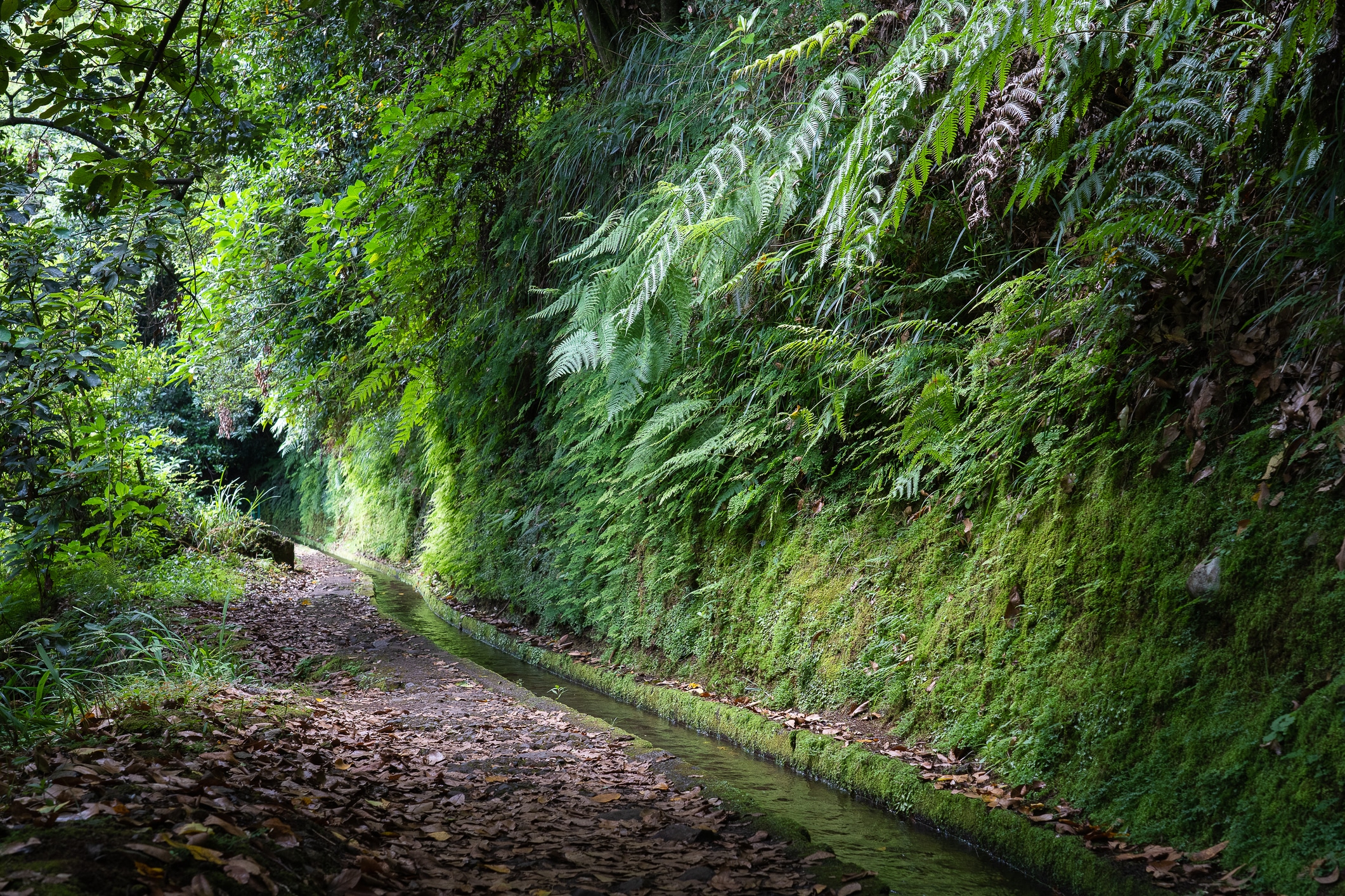
Levada do Rei, the King’s Levada, has earned its name. It’s one of those Madeira trails that doesn’t try to impress you with steep ridges or dizzying drops. Instead, it takes you deep into the island, where the only sounds are the water flowing along the channel and the birds in the crowns of old laurel trees.
The PR18 trail was closed from mid-March 2026 because of damage after heavy rain. After several weeks of work, clearing the route and installing new railings, IFCN (Madeira’s Institute of Forests and Nature Conservation) reopened it in April 2026. According to the IFCN list of 2 October 2026 the trail is open, and you can check its current status on the trail status page.
It’s a good moment to describe this trail from scratch, for anyone who’s only just planning a trip to Madeira.
Prefer to hike with a guide? Guided levada and mountain walks on Madeira, many with hotel pickup. Compare routes, reviews and prices on GetYourGuide.
The route step by step
The trail starts by the water treatment plant (ETAR) in Quebradas, above the village of São Jorge on Madeira’s north coast. Next to the start there’s a car park and a café, Quinta Levada do Rei. That’s worth knowing, because it’s your last chance to stock up before setting off.
A dirt track, the Caminho do Curralinho, leads from the tarmac road to the water station. The Levada do Rei runs alongside it here in a concrete channel, surrounded by agapanthus and eucalyptus. The start is easy and wide, still a long way from the wild-forest atmosphere that awaits further on.
After the water station and a concrete dam, you turn right and climb concrete-and-earth steps parallel to the levada, where the water rushes with real force. This is the only noticeable climb on the whole trail. Soon the path levels out and starts following the channel up the valley.
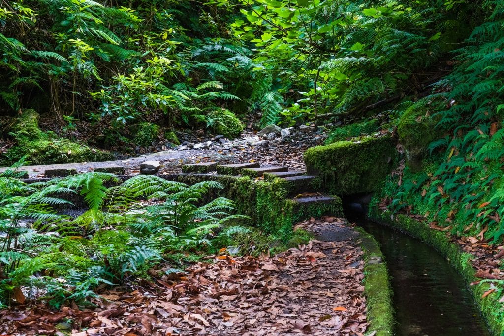
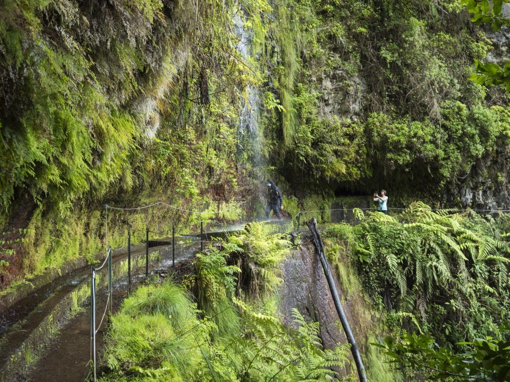
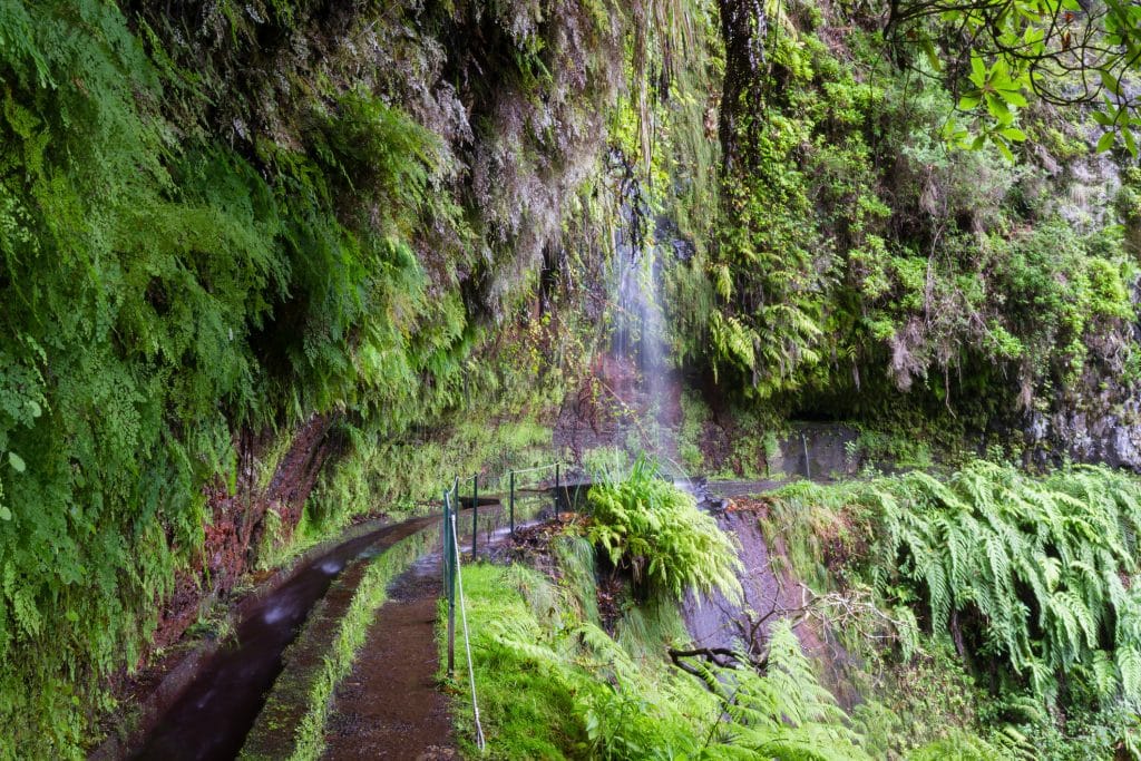
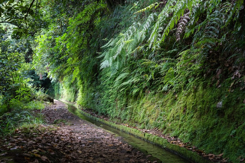
The first section leads through the wooded Achada do Milheiro valley. The trees limit the views here, but once you leave the valley a panorama opens up of Pico Ruivo and the forested ridges of northern Madeira, with Ilha and Santana in the background. The path is in good condition and not very exposed, though in places there are short sections with railings where the levada was cut into the rock.
The route winds around one side valley after another. In one of them you cross a river, one of the more “adventurous” moments on the trail. In the next, you cross the valley on triangular stepping stones in the stream bed. Further on, the path goes through a short, curved rock tunnel with stone slabs laid over the channel. Just before the tunnel the view opens up the valley, and after it, down the valley.
After the tunnel the trail turns right around a rocky corner, with railings and an overhanging rock. Don’t go down below the levada wall, even if you see a path leading lower: stick to the channel’s parapet.
The last section plunges you fully into the laurel forest. The sides of the valley close in noticeably and the vegetation gets thicker. There’s a good chance you’ll get wet: dripping rock overhangs hang over the path.
The finale: Ribeiro Bonito. The levada ends in a deep, steep gorge overgrown with huge til trees (Ocotea foetens), a member of the laurel family typical of the Macaronesian laurisilva. The trees here are tall and mossy, and the Ribeiro Bonito stream tumbles over fern-covered boulders. It’s one of those places in Madeira where you feel as if you’re in a forest from millions of years ago.
You come back the same way. The trail is linear (there and back), so on the return you see the same views from the opposite direction.
To the trailhead by car: many trailheads, such as Pico do Arieiro or Fanal Forest, can’t be reached by public transport. Compare car hire prices at Madeira Airport (FNC) on DiscoverCars.
The laurel forest: what makes this trail so special?
Levada do Rei leads through the laurisilva, a laurel forest that survived the ice ages in Madeira and is a relic of Tertiary flora. On 2 December 1999 UNESCO added Madeira’s laurisilva to the World Natural Heritage List, the only such listing in Portugal in the natural heritage category.
On the PR18 trail the laurisilva appears gradually: the first part of the route passes through mixed woodland with both native and introduced plants. From about halfway the forest changes character and you enter terrain dominated by endemic species: Madeira laurel (Laurus novocanariensis), til (Ocotea foetens) and vinhático (Persea indica).
Among the birds you might see here are the Madeira firecrest (Regulus ignicapillus maderensis) and the Madeiran chaffinch (Fringilla coelebs maderensis), both subspecies endemic to Madeira.
Another beautiful trail through the laurel forest is the Vereda do Fanal (PR13). If you’re after an even deeper dose of laurisilva, both are worth considering.
Why PR18 and not PR6?
Levada do Rei is often compared with Levada das 25 Fontes (PR6), the most popular trail in Madeira. Both routes lead through laurel forest and end by water, but the walks feel completely different.
PR6 has a one-way system and crowd control, and for good reason. In peak season the trail is swarming with visitors. PR18 is much quieter. It’s on the north coast, further from the main tourist centres, and attracts fewer people.
PR18 isn’t an “easier version” of PR6. It’s a different kind of experience: less visually spectacular at first, but with a powerful finale at Ribeiro Bonito and a deeper sense of wildness and seclusion.
The watermill: a bonus on the way back
In its notice about reopening the trail, IFCN mentions the São Jorge watermill (Moinho de Água), the only working mill in the region, powered by water from the Levada do Rei. The mill has around three centuries of history and still grinds grain from local terraced fields under the eye of a local miller.
Next to the mill is a historic water-powered sawmill (Serragem a Água), also driven by water from the Levada do Rei. Both are on the way between São Jorge and Quebradas, so it’s worth planning a visit on your way back from the trail.
Current trail status
You’ll find the regularly updated status of PR18 and all the other walking routes in Madeira on my Madeira trail status page.
 Read nextMadeira trail status. 🥾 Current list of IFCN routesIf you’re planning to hike in Madeira, don’t rely on guidebooks from a year ago. Trail statuses change, sometimes because of maintenance work, sometimes because of the weather or landslides after heavy rain. This page is updated regularly from official IFCN data. Last updated: 4 October 2026
Sources
IFCN notice on the reopening of PR18, via Madeira Island News Blog, 16 April 2026
Official PR18 trail sheet – IFCN
Visit Madeira – PR18 page
Paddy Dillon, Walking on Madeira, Walk 27: Levada do Rei from Quebradas
IFCN, Percursos Pedestres Classificados, updated 2 October 2026
SIGA – new route numbering from 9 March 2026 and the CAM “Rede Santana” timetable (accessed 16 October 2026), ticket prices from 1 April 2026 (Portaria n.º 128/2026)
Portaria n.º 801/2025 (10 December 2025) – table of trail fees for 2026
Portaria n.º 48/2026 (13 February 2026) – amendment to the fees
IFCN FAQ – Taxas Percursos Pedestres, updated 2 June 2026
Official guide to Madeira (Polish edition), Madeira Tourism Promotion Bureau
WalkMe Guide, TOP 10: Best levada walks in Madeira
No car? Book a fixed-price transfer from Funchal, e.g. to Porto Moniz, São Vicente, Calheta or the airport, in advance with Kiwitaxi.
⚠️ Important: madeira-planner.com is an independent guide I run as a hobby, where I share my own experience and what I’ve learnt during my stays in Madeira. I’m not a licensed mountain guide – everything here is for information and inspiration only.
Before every hike, check the current trail status on the official website of IFCN (Madeira’s Institute of Forests and Nature Conservation), check the weather forecast and be honest about your fitness. Conditions in the mountains can change fast – if you have no mountain trekking experience or are planning more demanding routes, consider hiring a qualified guide.
When you head out on the trails, you do so at your own risk. Your safety depends on the decisions you make.