
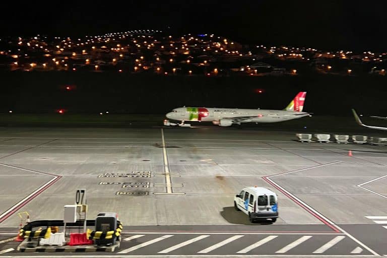

Flight disruption risk calculator — Funchal (FNC), Madeira
Wind and visibility forecast compared with the airport limits for your flight date
📅 Flight date
In difficult weather, flights are most often diverted to Tenerife (TFN/TFS) or Gran Canaria (LPA). Less often to Porto Santo (PXO) or back to airports in mainland Portugal, e.g. Lisbon (LIS).
Data: Open-Meteo (CC BY 4.0) · thresholds based on the LPMA airport wind limits from AIP Portugal (AD 2.20, edition of 1 October 2026), compared with the model forecast · this is a risk estimate, not an airport decision · check your flight status with your airline.
✈️ Madeira-Planner.com flight risk calculator
Landing in Funchal is not a routine operation – difficult weather sometimes makes it hard or even impossible. This calculator compares the wind and visibility forecast for your chosen date with the airport limits from AIP Portugal and estimates the risk of disruption to your flight.
The forecast is available 16 days ahead and updated several times a day. The closer to your flight date, the more accurate the result. This tool is for information and calculation only – for official information, always check with your airline.
A car from the airport: compare car hire prices at Madeira Airport (FNC) on DiscoverCars.
How does the Madeira flight risk calculator work?
Cristiano Ronaldo Airport in Funchal (LPMA) has one of the most operationally challenging locations in Europe. Runway 05/23 ends over the ocean, with a cliff on one side and water on the other – and mountains rising to 1800 m above sea level just a few kilometres from the runway threshold can throw the wind on approach completely out of kilter.
The result: flights scheduled to land in Funchal end up in Tenerife, Gran Canaria, Porto Santo or Lisbon, or even turn back to the airport they came from. I’ve witnessed diversions to Tenerife at least a few times during my stays.
This calculator checks the weather forecast for LPMA and estimates how high the risk of disruption (diversions, difficult landings) is on the day you choose.
Where does the weather data come from?
The forecast comes from Open-Meteo – a free weather platform based on European numerical models (including ECMWF). The data covers 16 days ahead and is updated several times a day. The closer your flight date, the more accurate the forecast.
What does the calculator check?
Funchal airport has mandatory wind limits published in AIP Portugal (LPMA AD 2.20). When they’re exceeded, the tower doesn’t clear aircraft to land – and airlines may have even stricter limits. The calculator compares the model’s hourly forecast with them, hour by hour from 6:00 to 23:00:
- Average wind and gusts. The limit depends on the wind direction. It’s strictest with a northerly wind (sector 300–010°): 15 knots average (about 28 km/h) and 25 knots in gusts (about 46 km/h). For the other directions in the AIP table it’s 20–25 knots average (about 37–46 km/h) and 25–30 knots in gusts (about 46–56 km/h). That’s why the same 50 km/h gust is within the limit one time and not the next.
- Wind direction. The AIP sectors are given in magnetic degrees, while the model gives the true (geographic) direction, so the calculator adds about 5° of declination. For directions the AIP doesn’t list (mainly wind blowing along the runway), I use my own general threshold: 25 knots average and 30 knots in gusts (about 46 and 56 km/h).
- Visibility. The approach requires visibility of at least 5 km (runway 05) or 7 km (runway 23). The model’s visibility forecast isn’t very accurate, though: over the last year the model showed less than 5 km five times more often than the airport actually measured. That’s why the calculator treats a forecast below 7 km as a warning sign (yellow), not as red.
How do you read the result?
🟢 No significant risk – at no hour between 6:00 and 23:00 does the forecast come close to the airport limits.
🟡 Delays possible – for at least 2 hours the forecast comes close to the limit (average wind at 80% of the limit or more, gusts within 5 knots of the limit, or visibility below 7 km), or it exceeds the limit for one hour. Flights often land in windows of better weather, but delays and holding over the island are possible.
🔴 High risk – for at least 2 hours the forecast exceeds the airport limit. In these conditions a diversion to Porto Santo, Tenerife, Gran Canaria or Lisbon, or a return to the departure airport, is possible. According to the airport’s measurements there were 59 such days in the last year, and in 2016–2026 they were most frequent in August, March and July.
The bar chart shows the gusts hour by hour – so you can see whether the difficult conditions fall in the morning or the evening, which matters when you’re judging how flexible your travel plans are. The colour of each bar shows how that hour compares with the limit for the forecast wind direction.
How did I check that the calculator works?
Before I changed the thresholds, I compared the method with reality. I took Open-Meteo’s hourly archived forecasts for the airport and set them against METAR reports from Funchal (wind measured every half hour, Iowa Environmental Mesonet archive) for the period from 1 October 2025 to 16 October 2026.
- On 59 days, the airport’s measurements exceeded the AIP limits for at least 2 hours. On those days the calculator would have shown red 42 times and at least yellow 51 times. The previous version (a fixed gust threshold of 74 km/h) would have shown red only 11 times.
- On the 38 toughest days (at least 4 hours above the limit), the calculator would have shown red 32 times.
- Of the 72 days with a red result, 42 were red in the measurements too, and 29 were days when the wind came close to the limit or exceeded it for less than 2 hours. Only once would the calculator have shown red on a completely calm day.
- On the 219 calm days, the calculator would have shown green 190 times.
So red means high risk, not a certain cancellation. It’s an approximation: METAR gives a 10-minute average from a single anemometer, while the tower looks at a 2-minute average from the sensors by the runway. The test is also based on short-range forecasts, so a result 10–16 days ahead is less certain than one a day or two before your flight.
I also checked how often the limits are exceeded over the year. In METAR measurements from 2016–2026 there were on average about 48 days a year when the wind exceeded the AIP limits for at least 2 hours. Most were in August, March and July (about 6 days a month each), and the fewest from October to December (about 2 days a month).
Straight from the airport to your hotel: book a fixed-price transfer from Madeira Airport (FNC) to Funchal and other towns in advance with Kiwitaxi. The driver tracks your flight, so they’ll wait if you’re delayed.
What doesn’t the calculator cover?
The numerical model for the airport’s grid point doesn’t account for the local effects created by Madeira’s terrain – rotors and downdrafts behind the ridges, or turbulence in the lee of the mountains when the wind blows from the northern sector.
In practice, the real conditions on approach may differ from the forecast. The calculator is a rough guide and doesn’t replace information from your airline.
The model forecast is for a grid point and for wind at a height of 10 m. It doesn’t replace the readings from the anemometers by the runway, which the tower’s decision is based on. Nor does the calculator know the limits of a specific airline or aircraft type.
If the calculator shows yellow or red for your flight date, it’s worth checking the terms for changing your booking, or taking out insurance that covers delays and diversions.
❓ Frequently asked questions
Can a flight to Madeira be cancelled because of wind?
Yes – Cristiano Ronaldo Airport in Funchal (FNC) is one of the more operationally demanding airports in Europe. The runway lies between a cliff and the ocean, and mountains rising to 1800 m above sea level a few kilometres from the runway threshold create turbulence in northerly and north-easterly winds that can make landing impossible. Cancellations and diversions happen regularly all year round, and the wind limits are most often exceeded in March and in July and August – they’re not an exceptional situation, just part of what makes this airport what it is.
How can I check the risk to my Madeira flight before I travel?
The calculator above fetches the current weather forecast for LPMA and compares the hourly forecast of average wind, gusts, wind direction and visibility with the airport limits from AIP Portugal. The forecast is available 16 days ahead. Just choose your flight date and click “Check the risk”. As well as using the calculator, keep an eye on your flight status directly in your airline’s app – especially 24–48 hours before departure.
Where are Madeira flights diverted in bad weather?
Most often to Tenerife – Norte (TFN) or Sur (TFS) airport – or to Gran Canaria (LPA). The Canary Islands are the natural alternate because they’re close and have plenty of hotels. Less often, planes return to airports in mainland Portugal, mainly Lisbon (LIS). After a diversion the crew has to take a mandatory rest (at least 10 hours), which in practice usually means the flight to Madeira doesn’t leave until the next day.
Is landing in Madeira safe?
Yes. LPMA meets all international safety standards. Pilots flying scheduled services to Funchal undergo additional training and approach simulations for this particular airport. If conditions don’t allow a safe landing, the pilot doesn’t attempt one – the flight is diverted or delayed until conditions improve. The airport’s bad press comes from its spectacular approach (low over the ocean, strong crosswinds) and frequent operational disruption, not from accidents.
At what wind speed are flights to Madeira cancelled?
The limits are set out in AIP Portugal (LPMA AD 2.20) and depend on the wind direction. With a northerly wind (sector 300–010°), landing is allowed up to 15 knots average (about 28 km/h) and 25 knots in gusts (about 46 km/h); for other directions up to 20–25 knots average (about 37–46 km/h). The approach requires visibility of at least 5 km (runway 05) or 7 km (runway 23). Airlines may have stricter limits. The wind is measured by anemometers by the runway as a two-minute average, so landing depends on the conditions at that moment, not on the daily forecast. Wind from the northern and north-eastern sector is particularly dangerous because of the turbulence created by Madeira’s mountains.
What time of year is the risk of flight disruption in Madeira highest?
As far as the wind limits alone go, they’re most often exceeded in summer and in March. I checked the airport’s METAR measurements from 2016–2026: days on which the wind exceeded the AIP limits for at least 2 hours were most common in August (about 20% of days), March (about 20%) and July (about 19%), and least common from October to December (6–8%). In summer a strong trade wind blows from the north – the direction for which the limits are strictest. In winter, Atlantic lows bring wind from the south and west, plus rain that reduces visibility. The calculator shows the forecast for a specific date, which tells you more than seasonal averages.
What should I do if my flight to Madeira is cancelled or diverted?
If you’re diverted, go to your airline’s service desk at the arrival airport as soon as possible and note down your reference number. The airline has to arrange transport and accommodation – if the hotels are full (which happens with mass diversions), book yourself and keep all your receipts. Strong wind usually counts as extraordinary circumstances (force majeure), which releases the airline from paying financial compensation (€250–600 under Regulation EC 261/2004), but not from providing care. Before you travel, it’s worth taking out travel insurance that covers delays and route changes.
Where does the calculator’s data come from and how reliable is it?
The calculator uses data from Open-Meteo (CC BY 4.0 licence) – a free weather platform based on models from ECMWF and other European meteorological institutes. The forecast is available 16 days ahead and updated several times a day. The closer to your flight date, the higher the accuracy. The calculator is a rough guide – numerical models don’t fully capture the local terrain effects of Madeira. Treat the result as a pointer, not a certainty. I tested the method against airport measurements from 1 October 2025 to 16 October 2026: on the 59 days when the wind exceeded the limits for at least 2 hours, the calculator would have shown red 42 times and at least yellow 51 times. The official source of information about your flight status is always your airline.
Flight delayed by more than 3 hours or cancelled? If it wasn’t caused by the weather (such as wind at the airport) or other extraordinary circumstances, you may be entitled to up to €400 in compensation on an EU flight (Regulation 261/2004). AirHelp checks your flight for free and only charges a fee if it wins.