A levada is a narrow irrigation channel that carries water by gravity from Madeira’s rainy north and mountains to the dry south. Many levadas have maintenance paths running alongside them, and today these are the island’s most popular trails. The whole network, including the distribution channels, is around 3100 km long. The most beautiful levada walks are PR6 Levada das 25 Fontes, PR6.1 Levada do Risco, PR9 Levada do Caldeirão Verde, PR18 Levada do Rei and the short PR11 to the Balcões viewpoint. IFCN trails require a booking and a €4.50 fee. See the table of routes.
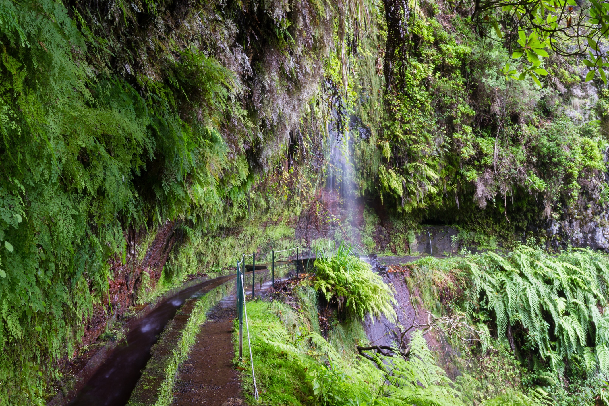
A levada (Portuguese levada) is a narrow irrigation channel that carries water by gravity from Madeira’s rainy north and mountains to the dry south. Many levadas have maintenance paths running alongside them, and today these are the island’s most popular walking trails.
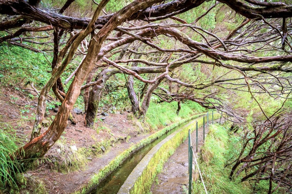
They don’t look like much. Just a narrow concrete channel with water flowing in it and a flat path next to it. It’s only when you find out that someone carved this channel into a basalt cliff by hand, often hanging on a rope more than a thousand metres up, and that the whole network is over 3100 kilometres long, that you start to understand what levadas really are.
Prefer to hike with a guide? Guided levada and mountain walks on Madeira, many with hotel pickup. Compare routes, reviews and prices on GetYourGuide.
What is a levada? A precise definition
A levada is an irrigation channel, not a trail. The trail runs alongside the levada. It’s a service path (in Portuguese esplanada) worn down by the levadeiros, the maintenance workers who clear the channel of leaves and silt. Over time these paths turned out to be perfect for walking and became one of the island’s main attractions.
The name comes from the Portuguese verb levar, “to carry, to lead”. A levada is literally “something that carries” (water). The name “levadas” was formally given by a Carta Régia of May 1493, a Portuguese royal charter referring to Madeira’s irrigation channels. The Portuguese borrowed the idea of irrigation by gravity-fed channels from the Moorish irrigation systems of the southern Iberian Peninsula: the Algarve and Andalusia.
The dimensions of a main levada are fairly consistent:
- 30–80 cm deep for older channels,
- 1–1.2 m deep
- and up to 1 m wide for those built in recent decades
- the path alongside is usually 1–2 metres wide.
In the past, the channels were built of stone and mortar. The oldest were cut into relatively soft volcanic rock, and where the builders hit hard basalt, they made wooden troughs to bridge the difficult section. Modern sections are made of cyclopean concrete.
The water flows by gravity alone. A levada has a minimal, precisely calculated gradient: enough for the water to flow, but small enough that it doesn’t erode the channel.
That’s why levadas “wander” along the contour lines, skirting valleys in long curves and cutting through mountains in tunnels. The channels are deliberately shallow and narrow, which limits evaporation.
Prefer to hike with a guide? Guided levada and mountain walks on Madeira, many with hotel pickup. Compare routes, reviews and prices on GetYourGuide.
The most beautiful levada walks in Madeira
Below I’ve picked the levadas that are the best place to start. Distance, time and difficulty come from Visit Madeira and IFCN, and the status from the IFCN list of 2 October 2026. Statuses change often, so check the trail status before you set off. For each of these trails you need a booking in SIMplifica and a €4.50 trail ticket (how to buy a ticket). You’ll find the full list of trails, including the veredas (footpaths), below and in the Madeira trails category.
| Levada | Start | Distance | Time | Difficulty | Status (IFCN, 2 October 2026) |
|---|---|---|---|---|---|
| PR6 Levada das 25 Fontes | Rabaçal (ER105) | 4.3 km + return by a loop path | approx. 3 h | moderate | open, one-way system |
| PR6.1 Levada do Risco | Rabaçal | 3 km + 3 km back | approx. 2 h | easy | open |
| PR9 Levada do Caldeirão Verde | Queimadas (Santana) | approx. 6.5 km + back the same way | n/a (whole route to Caldeirão do Inferno: 6 h 30 min) | moderate | open to Caldeirão Verde (since 29 May 2026); closed beyond |
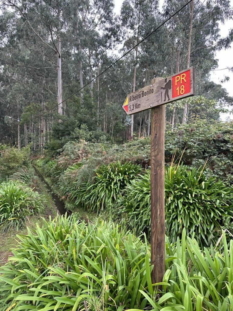
| PR18 Levada do Rei | Quebradas (São Jorge) | 5.3 km + 5.3 km back | approx. 3 h 30 min | moderate | open |
| PR11 Vereda dos Balcões | Ribeiro Frio | 1.5 km + 1.5 km back | approx. 1 h 30 min | easy | open |
| PR10 Levada do Furado | Ribeiro Frio → Portela | 11 km one way | approx. 5 h | moderate | open |
| PR14 Levada dos Cedros | Fanal → Curral Falso | 7.2 km one way | approx. 3 h | moderate | open |
| PR16 Levada Fajã do Rodrigues | São Vicente | 3.9 km + 3.9 km back | approx. 3 h 30 min | moderate | open |
PR6 Levada das 25 Fontes
Madeira’s most famous levada. It leads from Rabaçal through the laurel forest (UNESCO) to a small lake fed by springs and a waterfall. You walk there along the levada and come back on a loop path, because there’s a one-way system. Altitude 964–1288 m. It’s the trail that sells out most often, so book early. The Calheta council bus takes you to Casa do Rabaçal.
Levada das 25 Fontes and Risco: tickets, bus and getting there
PR6.1 Levada do Risco
The shorter, easier sister of 25 Fontes. From Rabaçal you walk to the Risco waterfall and come back the same way. It needs a separate booking (€4.50).
PR9 Levada do Caldeirão Verde
It starts by the triangular houses in the Queimadas forest park. This 18th-century levada leads through the laurel forest and four tunnels (take a torch) to a rock cauldron with a waterfall about 100 m high. Since 29 May 2026 the trail has been open again, but only as far as Caldeirão Verde. The further section to Caldeirão do Inferno remains closed. Parking at Queimadas is paid (€2/h, max. €10 per day). Next to the start is PR9.1, a 1.9 km wheelchair-accessible levada from Queimadas to Pico das Pedras.
PR18 Levada do Rei
The King’s Levada in São Jorge in the north. An almost flat path (535–573 m) through ever denser laurel forest to the Ribeiro Bonito gorge. A good, quieter alternative to the crowded PR6.
PR11 Vereda dos Balcões
The shortest walk on this list. Formally it’s a vereda (footpath), but it runs alongside the Levada da Serra do Faial. At the end is the Balcões viewpoint looking over the valley and, in good weather, to Pico do Areeiro, Pico das Torres and Pico Ruivo.
PR10 Levada do Furado
One of the oldest public levadas on the island. It leads through the laurel forest with views of Penha d’Águia. The trail ends somewhere other than where it starts, so plan how you’ll get back from Portela.
PR14 Levada dos Cedros
A 17th-century levada, one of the oldest in Madeira. It starts in the Fanal forest with its ancient til trees and descends to Curral Falso. The start and finish are on the same road, the ER209, but in different places.
PR16 Levada Fajã do Rodrigues
A short and very green levada in the São Vicente municipality. There are waterfalls along the way and lots of tunnels, so a torch is a must. You come back the same way.
Levadas for everyone. Two sections have been adapted for wheelchair users and families with pushchairs: PR6.8 Levada do Paul II (1.2 km, Rabaçal) and PR9.1 (1.9 km, Queimadas). Levadas outside the PR list, such as Levada dos Tornos, aren’t covered by the IFCN fee, but nobody is officially responsible for their condition. With a dog, it’s better to skip the most popular levadas; I write about this in my guide to Madeira with a dog. Closed (IFCN, 2 October 2026): PR7 Levada do Moinho and PR28 Levada da Rocha Vermelha.
How to choose a levada
- For your first time: PR6 or, if PR6 is sold out, PR18.
- For an hour or two: PR11 to Balcões or PR6.1 to the Risco waterfall.
- With waterfalls: PR6, PR6.1, PR9 and PR16.
- For a full day: PR10 from Ribeiro Frio to Portela.
How many levadas are there in Madeira? Sorting out the numbers.
Different sources give different lengths for the whole network: 800 km, 1400 km, 2170 km, 2790 km, 3000 km, 3100 km. Most of them are true; they simply count different things.
~3100 km: the whole network, including secondary distribution and irrigation channels. This is the official figure of the Regional Government of Madeira and UNESCO.
~2790 km: the public irrigation network managed by ARM (as of 2021). It serves 5324 ha of land and around 40,000 irrigators.
~2170 km: levadas with walking paths along them.
~800 km: the main public and private channels with water flowing all year round. These were the subject of the UNESCO application.
141 main levadas in total: 82 managed by ARM (drinking and irrigation water), 21 by EEM (hydroelectric power) and 31 by irrigation committees.
Figures for the tunnels vary too, but the latest official documents use 80 km of levada tunnels.
For comparison: Madeira covers just 737–742 km² and is 57 km long from east to west. That means there are more than 4 km of levadas for every square kilometre. No wonder the UNESCO application document compared the network to the island’s “circulatory system”.
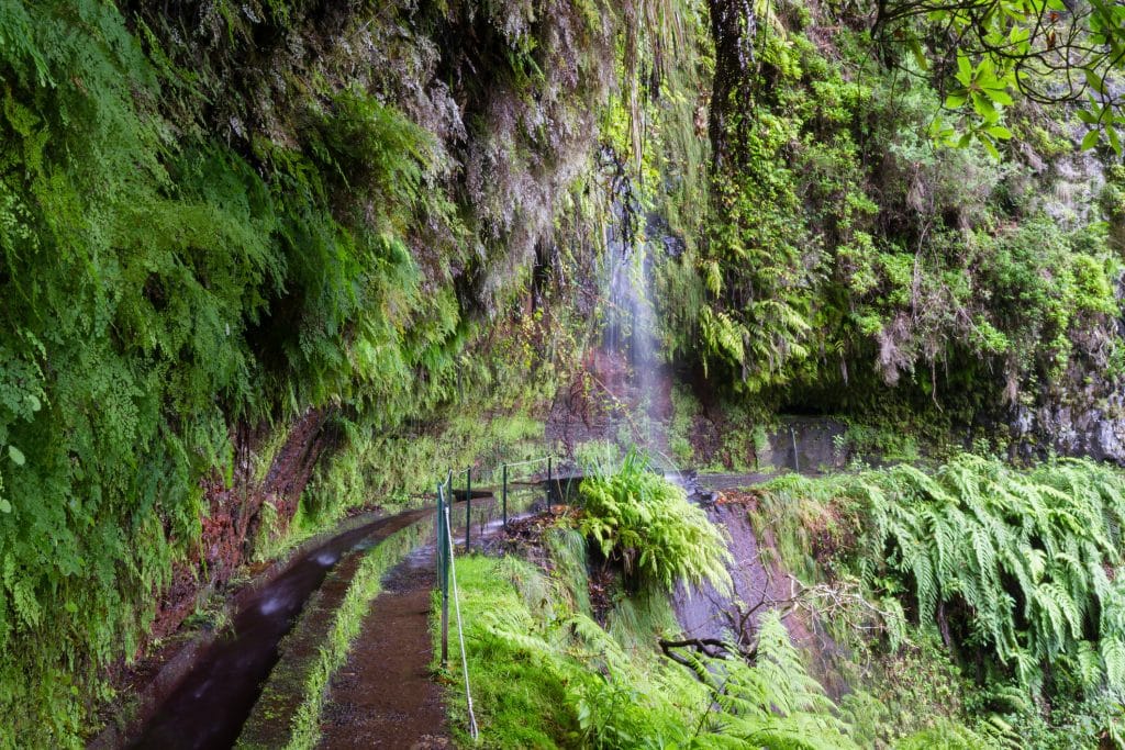
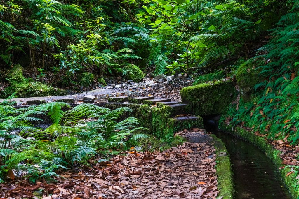
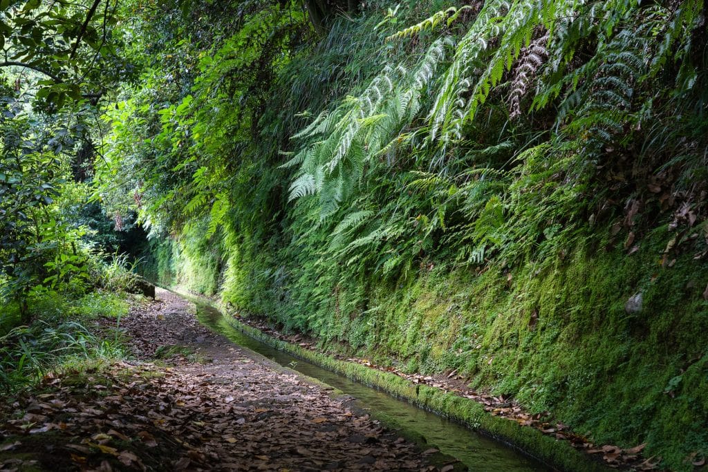
Why were the levadas built? Madeira’s geography and climate
Madeira has one fundamental problem: the water isn’t where it’s needed.
The central highlands and northern slopes catch the moist Atlantic trade winds. Rainfall in the highest parts of the mountains (Bica da Cana, Paul da Serra) reaches 3000 mm a year. Madeira Natural Park gets up to 2800 mm. The laurissilva laurel forest works like a sponge: it condenses moisture from the clouds and holds it in the soil. Orographic fog hangs at 800–1600 m for more than 200 days a year.
The south of the island and the far east are on the leeward side of the mountains and much drier. Funchal gets just 500–640 mm of rain a year. The Ponta de São Lourenço peninsula at the eastern tip is semi-desert: 600–1000 mm a year. And it was precisely in the south, thanks to the mild climate and sunny exposure, that the plantations were established.
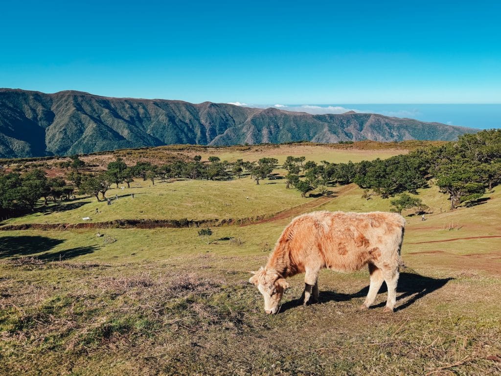
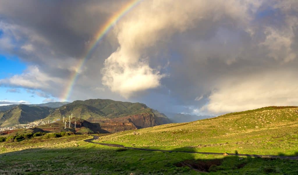
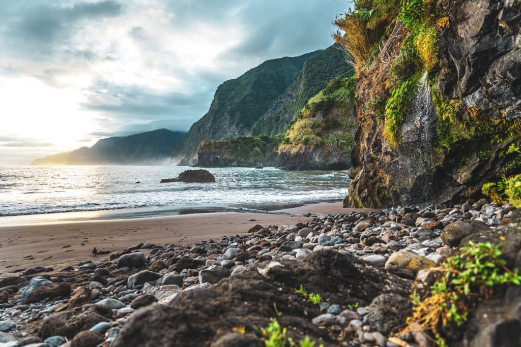
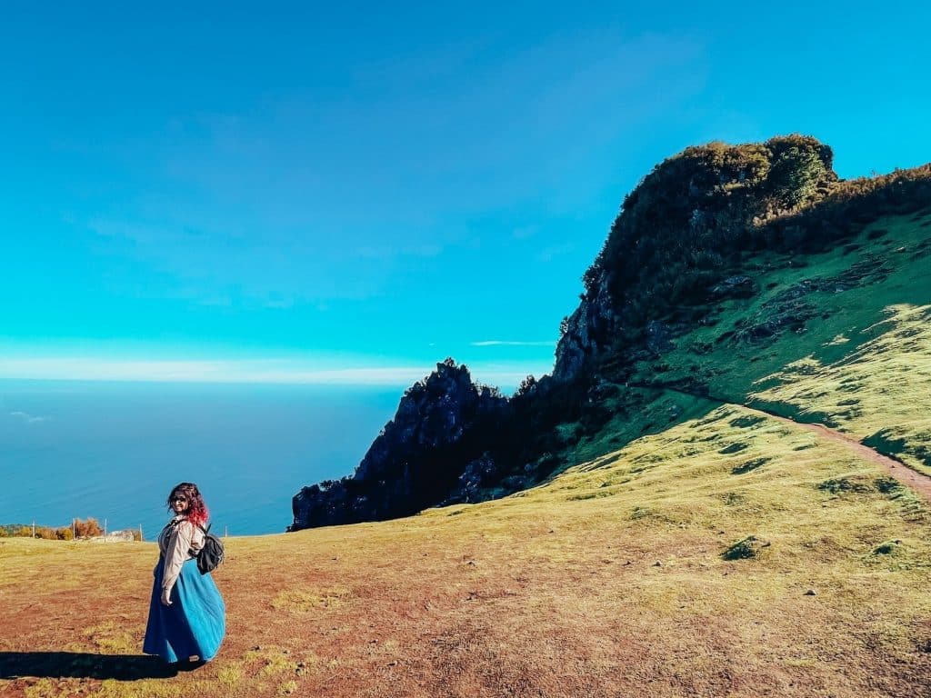
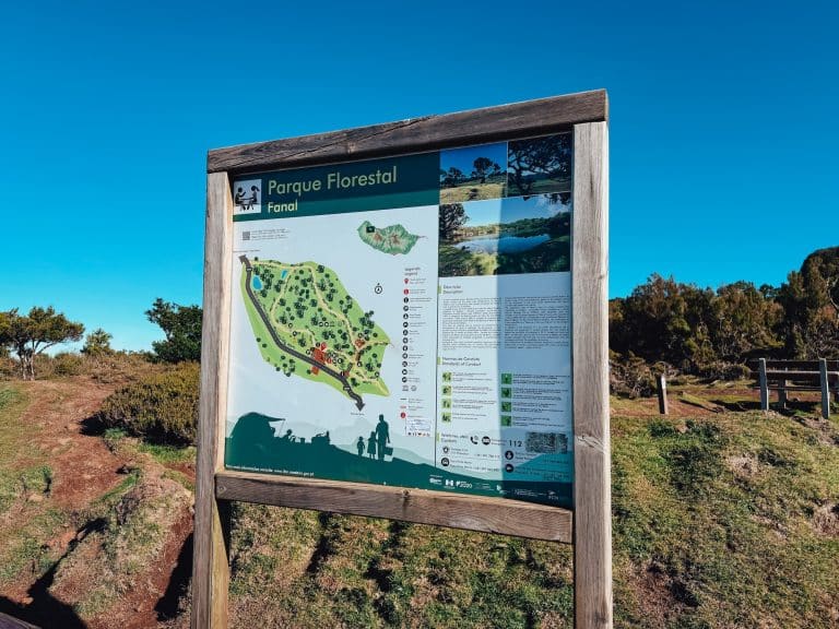
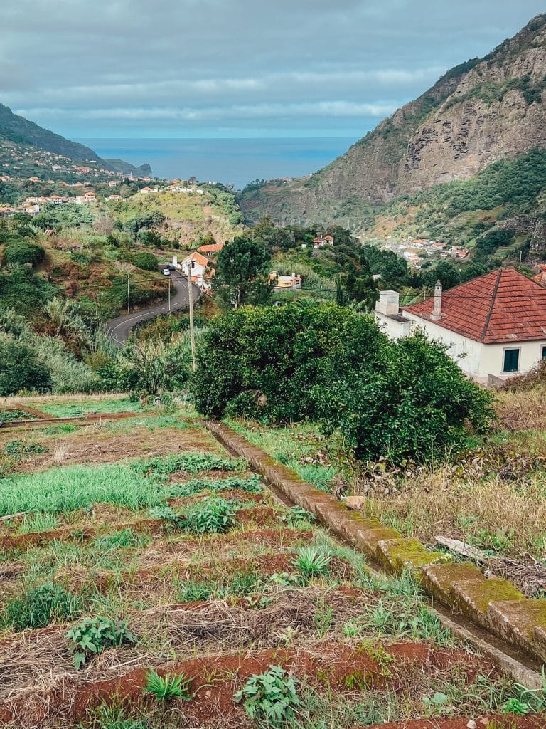
1: Photo: Ewelina Podrez-Siama – February 2026
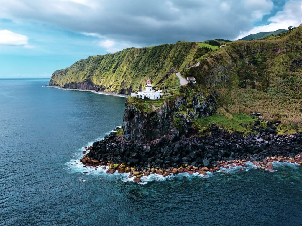
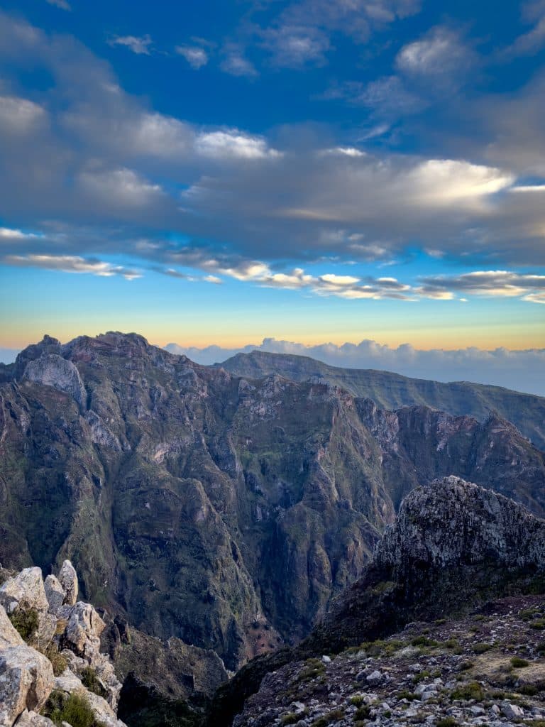
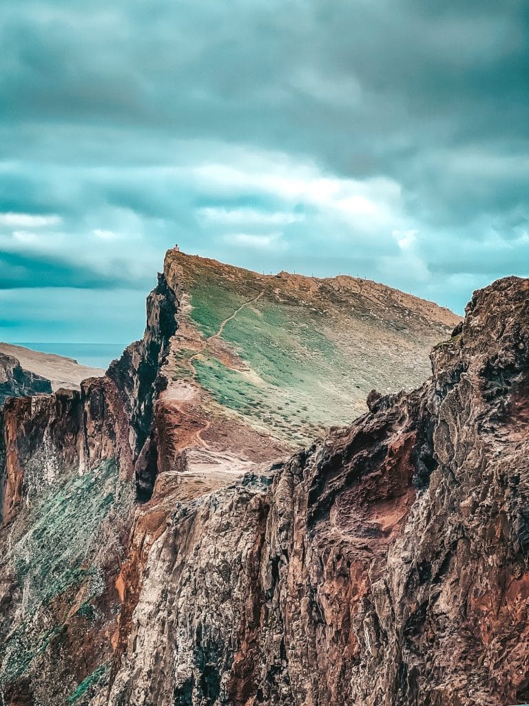
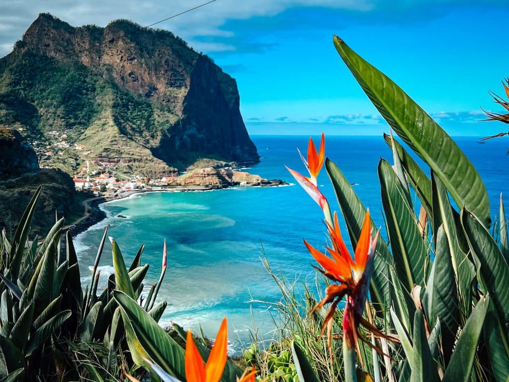
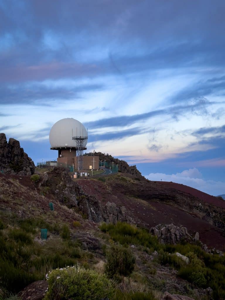
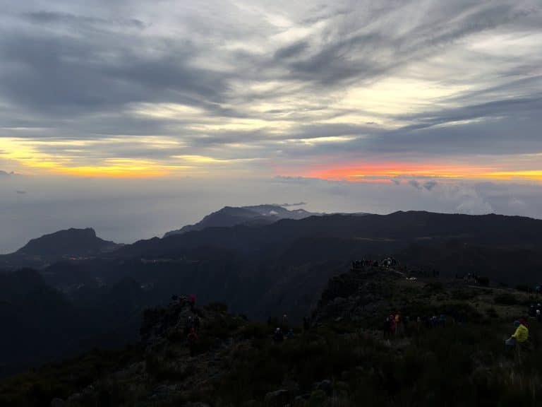
3: Photo: Ewelina Podrez-Siama 2023, 4: Photo: Ewelina Podrez-Siama 2023
 Read nextMadeira weather. 🌤️ Live forecasts and the island’s climate.Madeira’s weather now and month by month: forecasts for Funchal, Pico do Arieiro and Porto Santo, air and sea temperatures, and when to go to Madeira.
The first Portuguese settlers (from 1419) quickly realised that the key crop was sugar cane, which needs huge amounts of water. Sugar production in Madeira reached its first peak in 1506. In the 16th century there were 40 sugar mills on the island. Yet as late as 1947, Madeira’s irrigated area covered only 110 km² of its 300 km² of farmland: almost two thirds of the fields depended on unreliable rainfall.
The solution was as simple as it was ambitious: cut channels running just below the contour line, along the slopes, tunnelling through mountains where necessary. The water would flow on its own.
The history of Madeira and its levadas
The first levadas were built at the beginning of the 15th century, shortly after the island was colonised in 1419. They were short and simple, carved into relatively soft volcanic rock. They diverted streams from the valleys to sunny slopes cleared for farming. The main crop was wheat at first, and from the mid-15th century sugar cane, financed by Genoese bankers and drawing on Sicilian technical know-how.
In May 1493 the Carta Régia formally gave these channels the name “levadas”.
Building the levadas was extremely dangerous work. The Madeiran writer Adão Luiz de Oliveira described it in 1969:
In the arena of labour, the levada is built from the sum of human lives. The workers hang from barely secured ropes… with a smile on their lips, toying with death, more than a thousand metres up, hollowing out the basalt rock. — Adão Luiz de Oliveira, 1969
The official UNESCO document uses a separate term for this category of worker: rocheiros, men lowered in baskets on ropes tied to trees or rocky outcrops.
Slaves, convicts, levadeiros
This part of the story was left out of official narratives for a long time; the 2017 UNESCO application document doesn’t mention it at all. But the facts are well documented by historians.
Enslaved people were crucial to the sugar boom, working not only on the cane plantations and in the mills but also on building and maintaining the levada system. They were Guanches (from the Canary Islands), Berbers captured in North Africa and, after further exploration of the African coast, West Africans.
Slavery lasted in Madeira until 1775–1777. Madeirans themselves sometimes fell victim to the slave trade, too: in 1617 Barbary corsairs carried off 1200 people from Porto Santo. Alongside the enslaved, convicts from mainland Portugal and free labourers also worked on building the levadas.
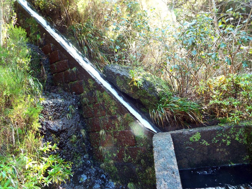
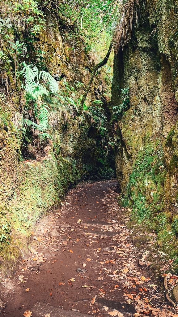
3: A stone levada channel near Rabaçal, February 2025, photo: Anita and Andrzej Podrez, 4: A rock cutting on the PR11 Vereda dos Balcões trail, November 2023, photo: Ewelina Podrez-Siama
16th–19th centuries: from private to state-owned
For the first four centuries, levadas were built entirely privately, paid for by landowners or by associations of co-owners called heréus. Only in the 19th century, facing a farming crisis after the collapse of wine exports (caused by phylloxera, an aphid epidemic), did the Portuguese government start investing in levadas and creating the first state-owned ones.
The first state-funded levada was the Levada Velha do Rabaçal, completed in 1860 after 25 years of construction. Until the mid-19th century the state’s role was limited to exploiting water resources and drawing up regulations for private levadas.
This was also when the conflicts began. State levadas started taking water from sources traditionally used by the local communities who had built the levadas, the heréus.
21 August 1962: the Revolta das Águas in Lombada da Ponta do Sol
To understand what happened in Lombada da Ponta do Sol, we have to go a long way back. From the 15th century the land there belonged to one of Madeira’s most powerful families, the Esmeraldos, who were granted the title of Morgada by King Manuel I in 1522. After the downfall of the family’s last heir (the Conde Carvalhal went bankrupt after lavish banquets), the land passed to a British wine company, Giorgi & C.ª. Finally, in 1936–37, Salazar, as Minister of Finance, bought the land and sold it to the settlers in instalments over 20 years, and, crucially, together with the right to the water of the Levada do Moinho. According to Gabriela Relva (in an interview with Jornal Mapa), “some annual instalments exceeded 1000 escudos, which at the time was an enormous sum, especially given the residents’ economic circumstances”.
In 1958 the Estado Novo (Salazar’s regime) began building the Levada Nova da Lombada, intended to divert water to the new Serra de Água hydroelectric power station. The farmers of Lombada soon realised they would lose the water they had paid for with generations of hard work.
On 6 May 1962 the then mayor called a meeting in the churchyard in Lombada and warned the residents that resistance would “end in tears of blood”. The residents ignored the warning and set off for Cabo da Levada, the point where water from the Ribeira da Ponta do Sol is diverted into the Levada do Moinho. From that day on, for three and a half months, they kept watch there around the clock.
At 5:00 in the morning on 21 August 1962, buses and jeeps carrying more than 200 officers of the PSP (Polícia de Segurança Pública) arrived at Cabo da Levada. They were commanded by Captain Luís da Costa Eduardo Rombert, an artillery captain. The guards blew búzios, seashells traditionally used as an alarm signal. The residents still at home rushed to Cabo da Levada.
The protesters took up a defensive formation: women and children at the front, men at the back, in the hope that the police would spare them. Captain Rombert announced through a megaphone: “You have five minutes to withdraw!”. Five minutes later the police opened fire and started beating people.
When the shooting began, seventeen-year-old Belmira da Conceição Gonçalves, known to her family and neighbours as Sãozinha, was among the last to arrive. Out of breath, she sat down on a stone by the wall, between Cecília Canha and Paizinha. She said: “I lost a shoe, but thank God I made it!”. A moment later she was hit in the forehead. She died in her neighbours’ laps.
Sãozinha was born on 18 April 1945 in Lombada, one of the 17 children of Manuel Gonçalves Júnior and Ana Conceição Silva Relva. She studied at the renowned Liceu Jaime Moniz in Funchal. On that day, 21 August, she only wanted to be with her people.
According to various sources, between 29 and around 70 people were arrested that day. All of them were held without trial from August to November 1962. Many of the wounded went to hospital first and, once discharged, straight to a cell. Sãozinha’s killing never went to court: the case was closed by an order (despacho) of the Ministry of the Interior that sided with the police.
A witness, Lurdes Teixeira, remembered: “It seemed like the end of the world; we thought everyone would die. It was a great slaughter. Screams from every side, people tried to run, but the police were hitting out blindly with truncheons, kicking, striking with rifle butts… They didn’t choose; they beat children, women and men alike. Many men were wounded in the legs by bullets.”
The state temporarily took control of the Levada do Moinho. New rules were introduced: night-time irrigation and time limits for each turn (turno). Some residents refused. One woman was arrested three times before the case went to court. The judge ruled in the residents’ favour, and a few months later he was posted to the war in Angola. This veiled reprisal, however, could not overturn the verdict.
Only after the Carnation Revolution of 25 April 1974 did the state formally recognise that the rightful owners of the water were the heréus, the co-owners who had bought it. In 2006 the Associação de Regantes da Levada do Moinho da Lombada e Lugar de Baixo was officially founded, and it still manages the water today according to the traditional usos e costumes, local customs. Its president is Gabriela Relva, Sãozinha’s own sister, a researcher and keeper of the memory of the Revolta das Águas.
On the 50th anniversary (2012), a sculpture by Gonçalo Martins commemorating the struggle was unveiled by the Solar dos Esmeraldos in Lombada, and the square was officially named “Largo da Luta das Águas da Lombada – 21 de Agosto de 1962”. Sãozinha is honoured locally as a heroína e mártir do povo, a heroine and martyr of the people. A popular folk song about her is still sung in the area:
O sangue que derramaste nas águas livres correu.
Ó Sãozinha, tu tombaste mas o teu povo venceu.
The blood you shed flowed in the free waters.
Oh Sãozinha, you fell, but your people won.
But the fight for water isn’t over. The Levada das Rabaças, built above the Levada do Moinho by the regional government, still takes more and more water today, sending it straight to the Serra de Água power station. This is a real threat to the Lombada community, especially with climate change and ever weaker rainfall (as Gabriela Relva warned in Jornal Mapa in 2024).
The Levada do Moinho in Lombada (Ponta do Sol municipality) is a different channel from the PR7 Levada do Moinho trail, which runs in the Porto Moniz municipality and is closed in October 2026. Every channel in Madeira carries a story. Sometimes a story of engineering and hard work. And sometimes, like this one, a story of blood shed in the fight for the basic right to water.
But the history of the levadas isn’t only about conflict. In the mid-20th century the state also launched the biggest modernisation project in their history.
1947: CAAHM and the great modernisation
In 1947 the Comissão Administrativa dos Aproveitamentos Hidráulicos da Madeira (CAAHM), the Administrative Commission for the Hydraulic Development of Madeira, was set up. Its task was a complete restructuring of the island’s water network. In its 20 years of work (until 1967):
- The levada network grew from 1000 to 1400 km (+400 km of new channels)
- The irrigated area grew from 110 to nearly 209 km² (almost all of Madeira’s farmland)
- 4 hydroelectric power stations were built, producing around 20% of the region’s electricity
- 100 km of new levadas were built at around 1000 m above sea level, 20 km of them in tunnels
20th century: the last levadas and electrification
The last big levadas were built under the CAAHM programme in 1947–1967. Today the system is mainly maintained rather than extended. Socorridos is now Madeira’s main hydroelectric power station, fed by the levada network and running all year round. The €34.7 million Socorridos modernisation project (€17.3 million from the EU) included building a 5.2-kilometre tunnel to increase water storage capacity. The total length of the tunnels and channels in the Socorridos project is 15.5 km.
21st century: UNESCO and a withdrawal
In 2017 Madeira’s levadas were added to UNESCO’s tentative list. The nomination covers around 800 km of main public and private channels. The 15th–16th-century levadas, which are no longer in use, were deliberately left out; the selection consists of 18th–20th-century channels that still work.
In 2024 the nomination was due to be considered at the 46th session of the World Heritage Committee in New Delhi. However, Portugal withdrew it after a negative recommendation from ICOMOS (UNESCO’s advisory body), which advised “not to inscribe”. The levadas remain on the tentative list and the nomination may be resubmitted.
How are levadas built? The engineering behind them.
The whole system relies on gravity and contour lines. The channels run with a very gentle gradient, parallel to the contours of the land. No pumps are used.
Three types of channel
Primary: usually above 1000 m, they collect water at its sources and carry it to the hydroelectric power stations and further down. These are the channels you see on most walks.
Secondary: distribution channels. They take water from the turbines or straight from the springs and distribute it to farms, reservoirs and crops. They have sluice gates opened and closed periodically by the administrator or the levadeiro.
Irrigation channels: the smallest, running at right angles from the main levadas down to individual terraced fields (poios). No constant flow. You won’t see these on the trails; they’re too narrow.
How the water is shared: giro and marcas de água
Water is distributed in a cycle called the giro, a regular rotation in which each irrigator is assigned a day, a time and a duration for watering their plot. Private levadas usually rotate every 15–20 days, state ones every 15 to 30 or even 40 days.
Along the main channels there are marcas de água, distribution boxes with precisely calibrated openings that control the flow. Along the routes you’ll also see small casas de água, distribution houses, some dating from the early 20th century (one of them, visible on PR10 Levada do Furado, was built in 1906).
Irrigators pay a fee called levadagem, which covers the wages of the levadeiros and maintenance costs. Today around 200 people work as levadeiros across Madeira.
Tunnels and aqueducts
Where a channel had to get through a mountain, a tunnel was dug. At first tunnels were cut by hand, with picks and hammers, later with gunpowder, and from the 19th century with modern techniques. The latest official figures (UNESCO) speak of around 80 km of levada tunnels. The longest single tunnel in the modern hydroelectric system, the upper reservoir of the Socorridos power station, is 5.2 km long (bored with a TBM).
Tunnels you can walk through, the ones that the levada walking trails pass through, are a completely different category. The tunnel on the Levada da Rocha Vermelha is 1.6 km long and takes about 20 minutes to walk (the PR28 trail is currently closed). The middle of the tunnel is so deep that you can’t see light at either end. A head torch is essential kit on many trails.
Path width and risk
Not all levadas are safe. The ones on level ground, in the forest, are. But some run along sheer cliffs, where a slip could be fatal. After the catastrophic landslides of 2010, some routes were fitted with railings, but not all of them.
Levadas today. Who manages them and how?
Today Madeira has 141 main levadas, managed by three groups:
- ARM (Águas e Resíduos da Madeira): 82 levadas. The main operator for mains and irrigation water, it manages a public network around 2790 km long, serving 5324 ha of land and 40,000 irrigators.
- EEM (Empresa de Electricidade da Madeira): 21 levadas that feed the hydroelectric power stations.
- Irrigation committees and associations: 31 levadas, mostly private, managed by the heréus under statutes that are sometimes hundreds of years old.
In addition, IFCN (Instituto das Florestas e Conservação da Natureza), Madeira’s Institute of Forests and Nature Conservation, is responsible for the walking trails along the levadas.
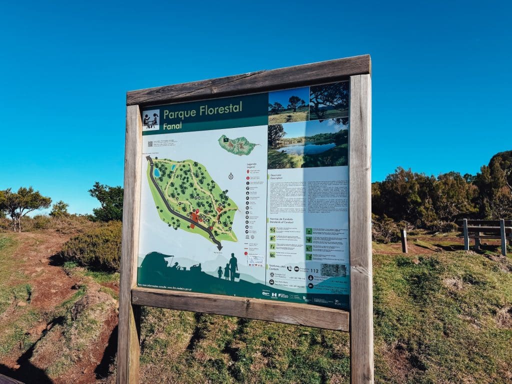
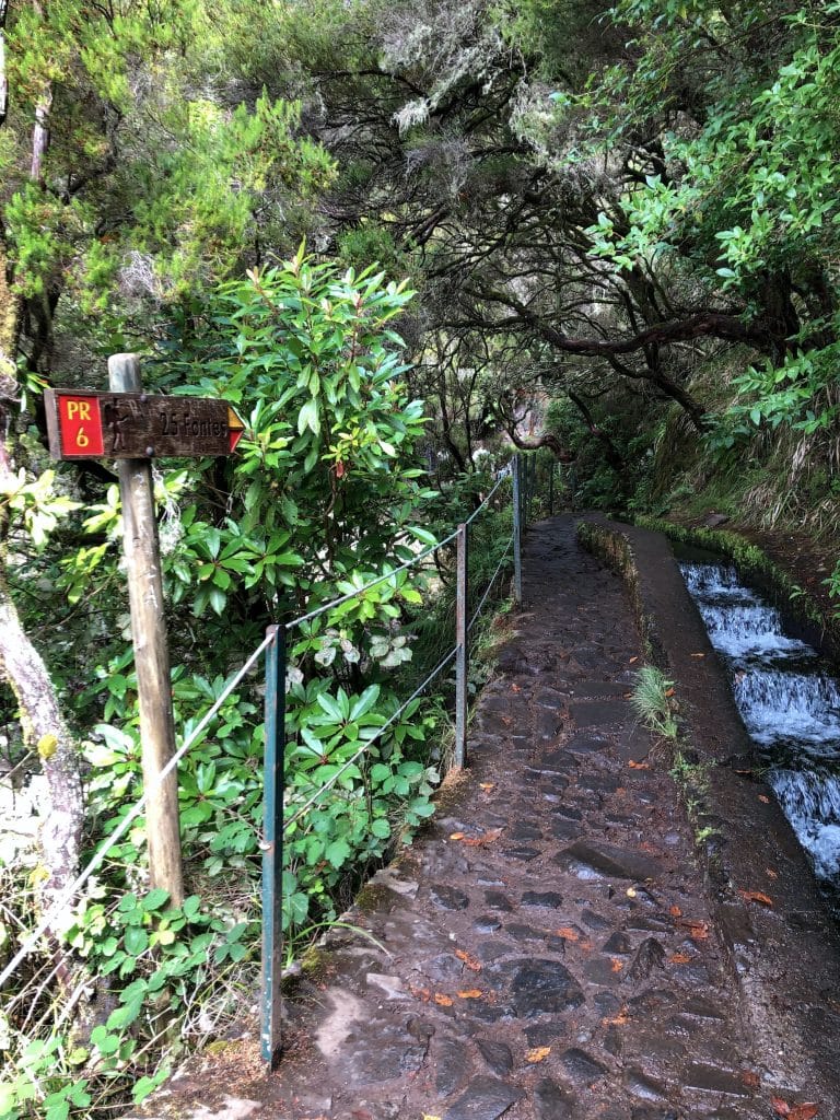
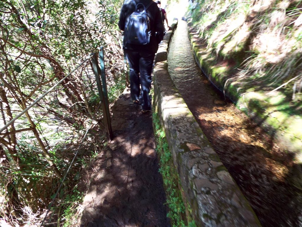
4: The Levada das 25 Fontes (PR6) channel and the path alongside it, February 2025. Photos: Anita and Andrzej Podrez
Levadas and renewable energy
In 2024 32.9% of the electricity produced in Madeira came from renewable sources, the highest share since the statistical series began (2009). In 2023 it was 27.9%. The regional government’s target for 2025 is 50%.
Trail fees from 2026
Since 1 January 2026, IFCN has required bookings and fees on the PR trails it manages (outside the system are PR3, PR3.1 and PR4, run by Funchal council, and PR23 in Caniço). Everyone has to book, including people exempt from the fee, and you do it on the SIMplifica portal, choosing an entry time.
 Read nextMadeira hiking trail tickets. 🎫 Simplifica step by stepSince 2026 you can’t walk Madeira’s official PR trails without booking online in advance, and the system only works through the government’s SIMplifica portal. Find out how to book and buy your trail ticket.
Levada vs vereda vs caminho real: the differences
Levada: a trail along a water channel. Practically flat, because it follows the contour line. Ideal for people with no mountain experience (with exceptions: exposed cliff sections, dark tunnels).
Vereda: a mountain path not directly linked to water. It often follows ridges or steep climbs. You need to be fit. Examples: Vereda do Areeiro (PR1), Vereda do Pico Ruivo (PR1.2), Vereda da Ponta de São Lourenço (PR8).
Caminho Real: the “royal road”, a historic route linking settlements, often paved with stone. Examples: PR3.1 Caminho Real do Monte, PR12 Caminho Real da Encumeada.
In Madeira the code PR stands for Percurso Pedestre Recomendado, “recommended walking route”. In mainland Portugal the same abbreviation means Pequena Rota, “short route”. PR trails are currently regulated by Regional Legislative Decree no. 24/2022/M. I collect descriptions of individual routes, including the veredas, in the Madeira trails category.
Glossary
Levada: an irrigation channel typical of Madeira; the name was formally given by the Carta Régia of May 1493.
Levadeiro: a levada keeper; the person who cleans the channel and opens and closes the sluice gates. Around 200 people currently do this job.
Heréus: the co-owners of a private levada, organised in committees with their own statutes.
Rocheiros: a historic group of workers lowered in baskets on ropes, who carved levadas into rock faces above sheer drops.
Giro: the rotation cycle for distributing water; 15–20 days for private levadas, 15–40 for state ones.
Levadagem: the fee paid by irrigators, covering the wages of the levadeiros and maintenance.
Luta da água / Revolta das Águas: “the fight for water” / “the water uprising”; local names for the events of 21 August 1962 in Lombada da Ponta do Sol.
Furado: a tunnel cut through rock (from the Portuguese furar, to pierce).
Poio: a terraced field on a slope, watered by branches of a levada.
Tornadoiro: the point where a levada splits; regulated by the levadeiro.
Marcas de água: distribution boxes along the main levadas, with precisely calibrated openings.
Casa de água: a small distribution house along a levada.
Esplanada: the service path running alongside a levada channel.
Ribeira: a stream or brook, a natural watercourse.
Laurissilva: the laurel forest, a UNESCO World Heritage Site since 1999.
All PR trails in Madeira: the full IFCN list
The official IFCN list of 2 October 2026 includes 39 PR trails in Madeira (including variants such as PR6.1–PR6.8), plus another 3 on Porto Santo. Some run along levadas; the rest are veredas and old royal roads. Below is the full list with a short description. Closed and partly open trails are marked, and you can check the current status of each route on the trail status page.
Levadas classified as PR trails
PR4 – Levada do Barreiro (Poço da Neve → Casa do Barreiro, 6.7 km). One of the highest levadas, through the Parque Ecológico do Funchal. It’s managed by Funchal council, so there’s no fee and no booking. Currently only partly open.
PR6 – Levada das 25 Fontes (Rabaçal → 25 Fontes, 4.3 km). One of the most famous levadas, ending at a small lake fed by 25 springs. It lies within the Laurissilva UNESCO area. There’s a one-way system: there along the levada, back on a loop path. The Rabaçal area also has the sub-trails PR6.1–PR6.8, including PR6.1 Levada do Risco (to the Risco waterfall), PR6.2 Levada do Alecrim, PR6.4 Levada Velha do Rabaçal and the wheelchair-accessible PR6.8 Levada do Paul II.
PR7 – Levada do Moinho (Ribeira da Cruz → Lamaceiros, 10.5 km). A levada in the Porto Moniz municipality, almost entirely through laurel forest, named after the watermills whose ruins you can see along the route. It isn’t the same Levada do Moinho that was fought over in Lombada in 1962. Currently closed.
PR9 – Levada do Caldeirão Verde (Queimadas → Caldeirão Verde → Caldeirão do Inferno, 8.7 km one way). The “Green Cauldron” ends at an amphitheatre of cliffs with a waterfall. Since 29 May 2026 the section to Caldeirão Verde (approx. 6.5 km) has been open; beyond it, to Caldeirão do Inferno, the trail is closed. The first section (PR9.1, 1.9 km) is wheelchair-accessible.
PR10 – Levada do Furado (Ribeiro Frio → Portela, 11 km). One of the oldest sections, a classic route through the laurel forest. Beside the route you’ll see a casa de água from 1906.
PR11 – Vereda dos Balcões (Ribeiro Frio → Balcões). It runs alongside the Levada da Serra do Faial. The easiest trail, about 3 km there and back, to a viewpoint with a panorama of the central mountains.
PR14 – Levada dos Cedros (Fanal → Curral Falso, 7.2 km). It leads from the mystical Fanal forest through high mountain terrain.
PR16 – Levada Fajã do Rodrigues (Fajã da Ama → Ribeira do Inferno, 3.9 km one way). Short and spectacular, with a long tunnel, cliffs and waterfalls.
PR18 – Levada do Rei (São Jorge). The “King’s Levada”: 10.6 km there and back, through the laurel forest to the Ribeiro Bonito spring, passing behind a waterfall.
PR23 – Levada da Azenha (Caniço, 1.3 km). A local farming levada managed by the Junta de Freguesia do Caniço (parish council): no fee and no booking.
PR28 – Levada da Rocha Vermelha (Fanal → Lombo da Atouguia, 10.7 km). Deep laurel forest in the west of the island and a long tunnel. Currently closed.
Levadas outside the PR list are popular too, for example the Levada dos Tornos near Monte and Camacha. They aren’t classified trails, so the IFCN fee system doesn’t cover them, but nobody is officially responsible for their condition either.
Vereda and caminho real trails
PR1 – Vereda do Areeiro (Pico do Areeiro → Pico Ruivo, 6.1 km). Madeira’s most iconic ridge trail. Closed after the fire of August 2024, fully reopened since 1 May 2026. From Pedra Rija onwards there’s a one-way system.
PR1.1 – Vereda da Ilha (Pico Ruivo → Ilha, 8.2 km)
PR1.2 – Vereda do Pico Ruivo (Achada do Teixeira → Pico Ruivo, 2.8 km). The shortest way up the island’s highest peak.
PR1.3 – Vereda da Encumeada (Pico Ruivo → Encumeada, 11.2 km). The Boca das Torrinhas – Encumeada section remains closed.
PR2 – Vereda do Urzal (Curral das Freiras → Boaventura, 10.3 km)
PR3 – Vereda do Burro (Pico do Areeiro → Ribeira das Cales, 6.7 km). Managed by Funchal council: no fee and no booking.
PR3.1 – Caminho Real do Monte (Ribeira das Cales → Monte, 5.5 km). Also no fee and no booking.
PR5 – Vereda das Funduras (Portela → Maroços, 8.7 km)
PR8 – Vereda da Ponta de São Lourenço (Baía d’Abra → Cais do Sardinha, 4 km one way). The easternmost peninsula, a semi-desert landscape and a Natura 2000 site. Since 30 September 2026 the trail has been undergoing upgrade works, with signposted detours.
PR12 – Caminho Real da Encumeada (Boca da Corrida → Encumeada, 12.5 km). Open only for the first 3.5 km from Boca da Corrida.
PR13 – Vereda do Fanal (Paul da Serra → Fanal, 10.8 km). It leads through the Fanal forest with its ancient laurel trees.
PR13.1 – Vereda da Palha Carga (Louro da Gota → 25 Fontes, 1.8 km)
PR15 – Vereda da Ribeira da Janela (Curral Falso → Ribeira da Janela, 2.7 km)
PR17 – Caminho do Pináculo e Folhadal (Lombo do Mouro → Encumeada, 15 km). Only the Encumeada – Folhadal – Caramujo – Bica da Cana section is walkable.
PR19 – Caminho Real do Paul do Mar (Prazeres → Paul do Mar, 1.8 km)
PR20 – Vereda do Jardim do Mar (Prazeres → Jardim do Mar, 1.9 km). Currently closed.
PR21 – Caminho do Norte (Encumeada → Ribeira Grande, 3.2 km)
PR22 – Vereda do Chão dos Louros (loop, 1.9 km)
PR27 – Glaciar de Planalto (Bica da Cana → ER105, 4.6 km). Currently closed.
The Rabaçal area also has the short veredas PR6.3, PR6.5, PR6.6 and PR6.7, which link up with the levada trails.
 Read nextMadeira trail status. 🥾 Current list of IFCN routesIf you’re planning to hike in Madeira, don’t rely on guidebooks from a year ago. Trail statuses change, sometimes because of maintenance work, sometimes because of the weather or landslides after heavy rain. This page is updated regularly from official IFCN data. Last updated: 4 October 2026
Back to where I started. Levadas don’t look like much. But when you stand above a channel that has been flowing without a break for two centuries, carved by hand by people hanging on ropes above thousand-metre drops, a channel that cost a seventeen-year-old girl her life on 21 August 1962 in the fight for her community’s right to water, and that now turns the turbines of hydroelectric power stations, it’s no longer “just a ditch”.
It’s one of Europe’s greatest underrated feats of engineering, on UNESCO’s tentative list, built by the hands of free labourers, convicts and enslaved people from the Canary Islands, North Africa and West Africa. And definitely the only one you can go for a walk along.
FAQ
What is a levada in Madeira?
A levada is an irrigation channel that carries water from the island’s rainy interior to the dry south and to hydroelectric power stations. A service path (esplanada) runs alongside the channel, and today it’s used for walking. The name comes from the Portuguese levar, “to carry”. It was formally given by the Carta Régia of May 1493.
How many levadas are there in Madeira?
The whole network is around 3100 km long. Of this, around 800 km are main channels with water all year round, around 2790 km are ARM’s public irrigation network (serving 5324 ha and 40,000 irrigators), and around 2170 km are levadas with walking paths along them. According to UNESCO, tunnels account for around 80 km. Madeira has 141 main levadas: 82 managed by ARM, 21 by EEM and 31 by irrigation committees.
When were the levadas built?
The first short channels were carved at the beginning of the 15th century, shortly after Madeira was colonised in 1419. The name “levada” was formally given in 1493 (Carta Régia). The first state-funded levada, the Levada Velha do Rabaçal, was completed in 1860. In 1947 the CAAHM was set up, and over 20 years it built 400 km of new levadas and 4 hydroelectric power stations. The last big levadas were built under the CAAHM programme in 1947–1967. Today the system is mainly maintained rather than extended.
Who built the levadas?
At different times: free Madeiran labourers, convicts from mainland Portugal and enslaved people: Guanches from the Canary Islands, Berbers from North Africa and, from the 16th century, West Africans brought in through the slave trade. Slavery in Madeira lasted until 1775–1777. The most dangerous work on the cliffs was done by the rocheiros, workers lowered in baskets on ropes, sometimes more than a thousand metres up.
Did anyone really die in the fight for water?
Yes. On 21 August 1962 a tragedy known as the Revolta das Águas took place in Lombada da Ponta do Sol. The residents, co-owners of the private Levada do Moinho who held titles with water rights bought from the state, had been keeping watch around the clock since May to stop the water being diverted into the new state-owned Levada Nova. Before dawn, more than 200 officers of the PSP (Polícia de Segurança Pública) surrounded the protesters. Seventeen-year-old Belmira da Conceição Gonçalves, known as Sãozinha, a pupil at the Liceu Jaime Moniz, was killed by a bullet to the forehead. Between 29 and 70 people were jailed (sources give different numbers). Only after the Carnation Revolution in 1974 was the water formally returned to the residents. On the 50th anniversary a monument was put up by the Solar dos Esmeraldos, and the square was named “Largo da Luta das Águas da Lombada – 21 de Agosto de 1962”.
Can you walk along the levadas?
Yes, and it’s the main way to explore the island’s interior. A path runs alongside most of the main levadas. The routes are marked with PR codes (Percurso Pedestre Recomendado) and vary in difficulty.
How much does a levada walk cost?
Fees have applied since 1 January 2026: €4.50 as standard, €3.00 on a tour run by an operator with an IFCN agreement, and €10.50 for PR1 (since 1 May 2026). Children under 12, Madeira residents and people with a disability of 60% or more are exempt. Booking through SIMplifica is compulsory.
Do you need to book a levada walk?
Yes. Since 2026 booking has been compulsory on the PR trails managed by IFCN (exceptions: PR3, PR3.1, PR4 and PR23). You book on the SIMplifica portal and choose an entry time. Walking without paying is an offence: the fine for an individual is €50 to €250, and for entering a closed trail €250 to €2500.
What’s the difference between a levada and a vereda?
A levada is a trail along a water channel: almost flat, following the contour line. A vereda is a mountain path, often with steep climbs along ridges. A Caminho Real is a historic road between settlements, often paved with stone.
Are the levadas a UNESCO World Heritage Site?
Not yet. They have been on UNESCO’s tentative list since 2017. In 2024 Portugal withdrew the nomination after a negative recommendation from ICOMOS. Madeira’s laurel forest (Laurissilva), however, has been on the UNESCO list since 1999.
Are the levadas still in use?
Yes. Most of the main levadas still carry drinking water, irrigation water and water for the hydroelectric power stations. ARM’s public network serves 5324 ha of land and 40,000 irrigators. In 2024, 32.9% of Madeira’s electricity came from renewable sources. The government’s target for 2025: 50%.
Where does the name “levada” come from?
From the Portuguese verb levar, “to carry, to lead”. A levada is literally “something that carries” (water). The name was formally given to Madeira’s channels by the Carta Régia of May 1493. The Portuguese borrowed the idea of irrigation by gravity-fed channels from the Moorish systems of Andalusia and the Algarve.
Which is the most beautiful levada in Madeira?
The most popular choices are PR6 Levada das 25 Fontes (a small lake and waterfalls in the laurel forest) and PR9 Levada do Caldeirão Verde (tunnels and a rock cauldron with a waterfall of about 100 m). PR18 Levada do Rei in the north of the island is quieter.
Which is the easiest levada walk?
PR11 to the Balcões viewpoint: 1.5 km one way, about 1 h 30 min there and back, easy. For wheelchairs there’s PR6.8 Levada do Paul II (1.2 km) and PR9.1 from Queimadas to Pico das Pedras (1.9 km).
Are all the levadas open?
No. According to the IFCN list of 2 October 2026, PR7 Levada do Moinho and PR28 Levada da Rocha Vermelha are among the closed trails, and PR4 Levada do Barreiro is only partly open. Statuses change after heavy rain and landslides, so check on the day you go.
Do you need a torch for a levada walk?
On some routes, yes. PR9 Levada do Caldeirão Verde has four tunnels, and PR16 Levada Fajã do Rodrigues has lots of them. A head torch is the most practical.
Do you need a guide for the levadas?
No. You can walk the waymarked PR trails on your own once you’ve booked in SIMplifica. With an operator that has an agreement with IFCN, the trail fee is €3 instead of €4.50.
Sources and bibliography
This guide is based on primary sources (official documents, scientific publications, ethnographic research, interviews with participants and their families) and verified secondary sources. The sections below cover all the facts, figures and quotations given in the text. Click a heading to expand the list.
▸ Scientific and peer-reviewed publications
Fernandes, F. (2025). Waterscapes, memory and tourism: Materiality and place-making around Madeira’s levadas. Shima, 19(1), 244–265. https://doi.org/10.21463/shima.244
Greenfield, S. M. (1977). Madeira and the Beginnings of New World Sugar Cane Cultivation and Plantation Slavery: A Study in Institution Building. Annals of the New York Academy of Sciences, 292(1), 536–552.
Baioni, D. (2011). Human activity and damaging landslides and floods on Madeira Island. Natural Hazards and Earth System Sciences, 11(11), 3035–3046. https://doi.org/10.5194/nhess-11-3035-2011
Prada, S., Perestrelo, A., Sequeira, M., Nunes, A., Figueira, C. & Cruz, J. V. (2005). Disponibilidades Hídricas da Ilha da Madeira. In: A. Romero Ortega (ed.), Proyecto AQUAMAC: técnicas y métodos para la gestión sostenible del agua en la Macaronesia (pp. 261–294). Instituto Tecnológico de Canarias, Cabildo de Lanzarote, Consejo Insular de Aguas de Lanzarote.
Quintal, R. (2001). Levadas e Veredas da Madeira. 3rd edn. Edições Francisco Ribeiro, Funchal, 285 pp. The author is a long-standing researcher at the University of Lisbon and a former Environment Councillor at the Câmara Municipal do Funchal. Further works by Quintal from 1989–2001 are cited indirectly via Fernandes (2025).
▸ Sources on the Revolta das Águas (1962)
Olival, F. (2024). Águas Revoltosas da Ilha da Madeira. Jornal Mapa, issue #40 (January–March 2024); published online 28 September 2024. Based on interviews with Gabriela Relva, Sãozinha’s sister and president of the Associação de Regantes da Levada do Moinho. Available at: jornalmapa.pt
Teixeira, Ó. (11 August 2022). Sãozinha, a heroína mártir da Ponta do Sol. Diário de Notícias da Madeira. Includes the full text of the inscription on the monument by the Solar dos Esmeraldos. Available at: dnoticias.pt
Belmira da Conceição Gonçalves. Memória Comum, a database of victims of political repression under the Estado Novo regime. Includes Sãozinha’s biography, eyewitness testimony (Lurdes Teixeira) and popular quadras (folk verses). Available at: memoriacomum.org
Sãozinha. Wikipédia (Portuguese edition). Available at: pt.wikipedia.org/wiki/Sãozinha
Relva, G. (2012). A Revolta das Águas na Lombada da Ponta do Sol. Mundo Rural Online (published by Acção Católica Rural). The original source of the family’s account. The original URL, mundo-rural.webnode.pt, is no longer available; the text survives in quotations on Portuguese Wikipedia and Memória Comum.
Oliveira, A. L. de (1969). Arquipélago da Madeira: Epopeia Humana. Braga: Editora Pax, 248 pp. Cited in Fernandes (2025) as the source of the historical description of the work on building the levadas.
▸ Official documents and institutions
Levadas of Madeira Island (tentative list ID 6230). UNESCO World Heritage Centre. Nomination document from 2017, withdrawn from the inscription process in 2024. Available at: whc.unesco.org/en/tentativelists/6230
Laurisilva of Madeira (UNESCO list entry 934, 1999). UNESCO World Heritage Centre. Includes technical descriptions of the levadas that pass through the laurel forest. Available at: whc.unesco.org/en/list/934
Levadas of Madeira Island – nomination history. worldheritagesite.org. Records the 2024 decision: “Requested by State Party to not be examined. After a Not to inscribe advice by ICOMOS”. Available at: worldheritagesite.org
CAAHM – Comissão Administrativa dos Aproveitamentos Hidráulicos da Madeira (1969). O aproveitamento da água na ilha da Madeira. Ministério das Obras Públicas, Gráfica Brás Monteiro. Cited indirectly via Fernandes (2025); the original document is held in Madeiran archives.
ARM – Águas e Resíduos da Madeira (2024). Data on the public irrigation system: 2790 km of channels, 5324 ha of land served, 40,000 irrigators. Available at: arm.pt
Visit Madeira / Direção Regional de Turismo. The official guide Madeira and Porto Santo (Polish edition) and the website visitmadeira.com: information on walking trails and the 2026 SIMplifica fees.
IFCN – Instituto das Florestas e Conservação da Natureza. The current list of classified PR trails. Available at: ifcn.madeira.gov.pt
SIMplifica – Madeira’s trail booking portal. Available at: simplifica.madeira.gov.pt
DREM – Direção Regional de Estatística da Madeira (2025). Data on electricity production (32.9% from renewables in 2024). Cited by Madeira Island Direct, February 2025.
Decreto Legislativo Regional n.º 24/2022/M. The current legal framework for walking trails in the Autonomous Region of Madeira. Available at: ifcn.madeira.gov.pt
▸ Guidebooks and studies
Dillon, P. (2018). Walking on Madeira: 60 mountain and levada routes on Madeira and Porto Santo. 3rd edn. Cicerone Press, ISBN 978-1852848552, 320 pp. (reprinted 2023). Includes historical background on the levadas and one of the first English-language mentions of the events in Jangão in 1962.
Walking Madeira’s Levadas. Official Visit Madeira brochure (2012). Describes the heréus system and the history of the Levada do Moinho.
Whitehead, M. & Whitehead, S. (2009). Walk! Madeira. Discovery Walking Guides Ltd. Cited in Fernandes (2025).
Découverte de Madère : Les levadas. Petit Futé (French edition). Gives the completion date of the Levada Velha do Rabaçal (1835–1860) and the background to the 1947 modernisation. Available at: petitfute.com
▸ Madeira’s historical background
Madeira. Wikipedia (English edition). Historical background on colonisation and slavery, and data on the levada network. Available at: en.wikipedia.org/wiki/Madeira
History of Madeira. Wikipedia (English edition). Detailed background on the sugar trade and slavery. Available at: en.wikipedia.org/wiki/History_of_Madeira
Levada (Madeira). Wikipedia (English edition). Technical data on channel and tunnel dimensions. Available at: en.wikipedia.org/wiki/Levada_(Madeira)
Madera. Wikipedia (Polish edition). Available at: pl.wikipedia.org/wiki/Madera
Cartwright, M. (2021). The Portuguese Colonization of Madeira. World History Encyclopedia. Available at: worldhistory.org
Solar dos Esmeraldos. Wikipédia (Portuguese edition). The history of the manor house and the Esmeraldo family; Sãozinha’s monument stands beside it today. Available at: pt.wikipedia.org/wiki/Solar_dos_Esmeraldos
▸ Journalism and media
Madeira’s levadas: An ingenious system. Oceanographic Magazine, November 2024. Includes current data on the network (3100 km, 80 km of tunnels). Available at: oceanographicmagazine.com
How did Madeira become the EU’s poster child for renewable energy? Euronews, July 2023. On the role of the levadas in energy production. Available at: euronews.com
Madeira develops hydropower for use all year round. European Commission, Inforegio. Data on the Socorridos project and the length of the tunnels (15.5 km in total). Available at: ec.europa.eu/regional_policy
Cafofo, P. & Sousa, L. R. (2007). Innovative underground works at Socorridos, Madeira Island, Portugal. Workshop in Volcanic Rocks, Ponta Delgada, 73–80. Technical source for the length of the Socorridos tunnel (5.2 km, TBM, reservoir capacity 36,000 m³).
A ‘Revolta das Águas’ na Escola da Lombada. Jornal da Madeira, 4 May 2024. On an educational exhibition run by Gabriela and Margarida Relva at the EB1/PE school in Lombada. Available at: jm-madeira.pt
Revolta perpetuada na Lombada da Ponta do Sol. Blog Ponta do Sol, 22 August 2007. A report on the 45th anniversary commemorations and information about the first sculpture (by Sílvio Cró).
Comemoração dos 50 anos da Revolta das Águas de 1962 na Lombada da Ponta do Sol. Blog Nobicodaquebrada, 30 August 2012. Names the sculptor of the monument put up in 2012 (Gonçalo Martins).
New Madeira Hiking Trail Fees for 2026. HikingMadeira.com, December 2025; Madeira Hiking Fees 2026. Salt in Our Hair, 2026; Madeira Trail Reservations 2026. Beyond Madeira, March 2026. Verified fees and SIMplifica rules for 2026.
▸ Climate and weather data
Rainfall data for Madeira (3000 mm in the centre of the island, 500–640 mm in Funchal, 600–1000 mm at Ponta de São Lourenço) verified against Prada et al. (2005) and Baioni (2011), the scientific publications cited above.
IPMA – Instituto Português do Mar e da Atmosfera. Available at: ipma.pt. Portugal’s archive of weather data, including Madeira.
Editorial note
Quotations from Portuguese in the text are my own translations. The original excerpts from ethnographic interviews (Luísa, Ana, Joaquim, Lurdes Teixeira) come from Filipa Fernandes’s research (2009–2022), published in an article in Shima Journal (2025), and from the Memória Comum records.
Where sources disagree (e.g. the number of people arrested on 21 August 1962: 29 according to Memória Comum, around 70 according to Jornal Mapa), I’ve given both versions, in the interest of factual transparency.
To the trailhead by car: many trailheads, such as Pico do Arieiro or Fanal Forest, can’t be reached by public transport. Compare car hire prices at Madeira Airport (FNC) on DiscoverCars.
⚠️ Important: madeira-planner.com is an independent guide I run as a hobby, where I share my own experience and what I’ve learnt during my stays in Madeira. I’m not a licensed mountain guide – everything here is for information and inspiration only.
Before every hike, check the current trail status on the official website of IFCN (Madeira’s Institute of Forests and Nature Conservation), check the weather forecast and be honest about your fitness. Conditions in the mountains can change fast – if you have no mountain trekking experience or are planning more demanding routes, consider hiring a qualified guide.
When you head out on the trails, you do so at your own risk. Your safety depends on the decisions you make.