- Where: a village at the bottom of a valley in the middle of the island, about 650 m above sea level, in the municipality of Câmara de Lobos. About 16 km and about 20 minutes by car from Funchal through the tunnel.
- Viewpoint: Eira do Serrado (1095 m), 300 m from the car park along a path with steps.
- On foot: the old cobbled path from Eira do Serrado down to the village, 2.7 km and about 440 m of descent.
- Bus: route 181 from the lower station of the Monte cable car, €2.65 from the driver. Only some services go via Eira do Serrado.
- Festival: Festa da Castanha, the chestnut festival, on 1 November.
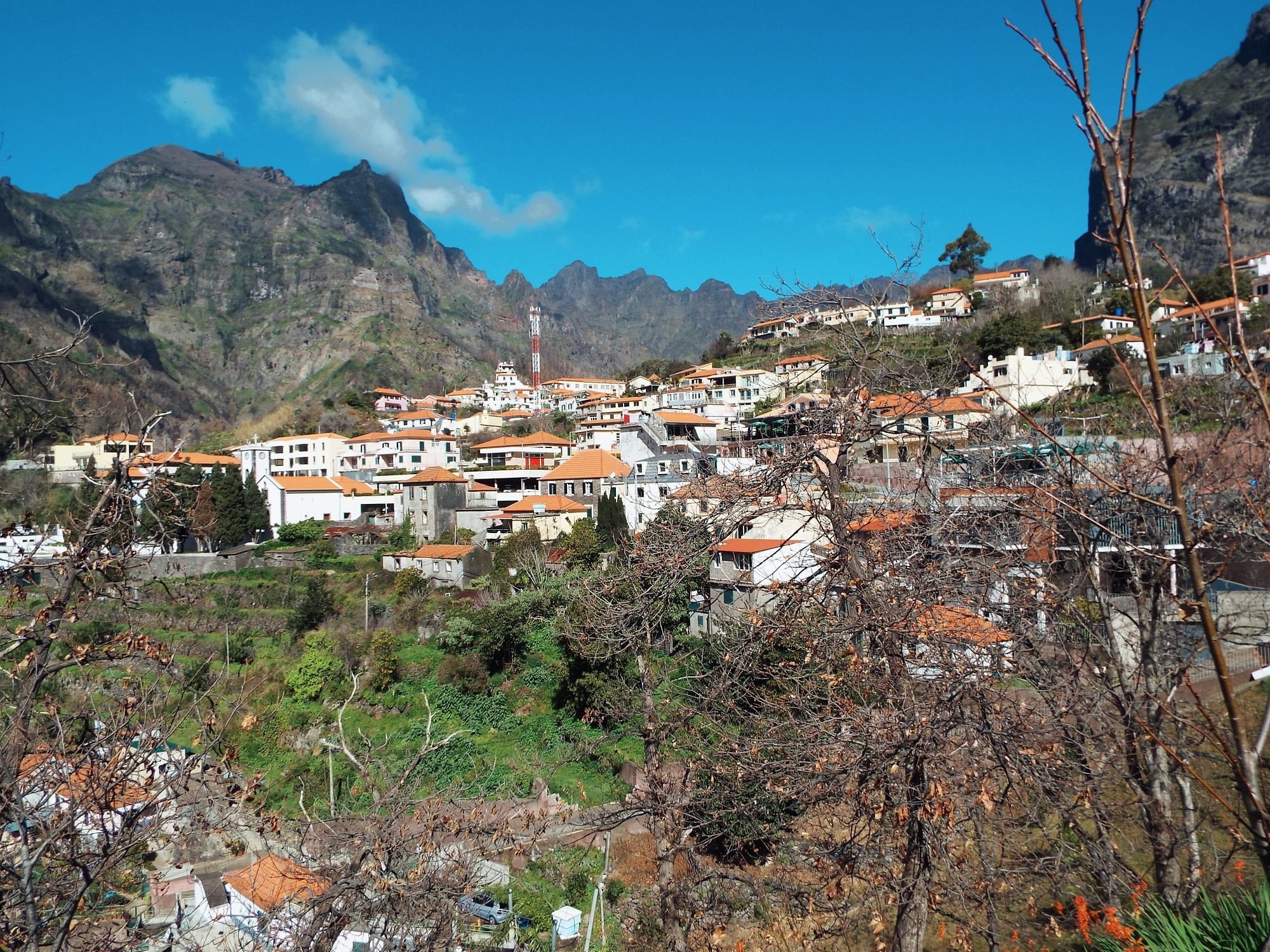
From the terrace at Eira do Serrado you look more than 400 metres down onto the rooftops of a village ringed by walls of mountains. Until 1959 no road for cars led here, and from the sea you can’t see the valley at all. Curral das Freiras, the Nuns’ Valley, shows better than anywhere how steep and wild the interior of Madeira is. Below you’ll find the viewpoints, how to get there by car and by bus, the walk down the old path, the chestnuts and the festival on 1 November.
Where is Curral das Freiras?
Curral das Freiras is a parish (freguesia) of the municipality of Câmara de Lobos, and the largest one in it: 25 km². The village lies in a basin in the central part of the island, about 650 m above sea level, closed in by mountains on every side except the south. In 2021, 1580 people lived here. The peak was in 1970, with more than 2700.
| From Funchal to | Distance | Time by car |
|---|---|---|
| Eira do Serrado (viewpoint) | 14.6 km | about 20–25 min |
| Curral das Freiras (church) | 15.6 km | about 20–25 min |
Why is it called the Nuns’ Valley?
“Curral” is Portuguese for a pen or corral. The first settlers grazed sheep and goats here, so the place was simply called Curral or Curral da Serra. In 1480 the land was bought by João Gonçalves da Câmara, the second captain-donatary of Funchal, who gave it to the Santa Clara convent as his daughters’ dowry. From then on the valley belonged to the Poor Clare nuns.
The most famous story dates from October 1566. French corsairs led by Bertrand de Montluc landed at Praia Formosa on 3 October and plundered Funchal for 16 days. About 300 people were killed. The nuns fled into the mountains, to “their Curral”, taking only the monstrance with the Blessed Sacrament. They returned to the convent once the French had sailed away. Some historians think the name “das Freiras” (of the nuns) had caught on earlier, when the land passed to the convent. But it was the escape of 1566 that turned the valley into a legend.
Eira do Serrado: the viewpoint above the valley
Eira do Serrado sits at 1095 m, more than 400 m above the village. A 300-metre path with steps leads from the car park to the viewing terrace. The semicircular terrace measures about 200 m² and has a metal railing. From here you see the whole parish: the village at the bottom, the terraces on the slopes, the hairpin bends of the road and the mountains closing off the valley to the north. On the western slope, look out for the line of the Levada da Velha, a levada that was never finished.
Next to the car park stands the Eira do Serrado hotel with a restaurant and terrace. When the clouds hang low, all you’ll see from the viewpoint is white, so check the Madeira weather before you set off.
Miradouro do Paredão
Higher still, at about 1500 m above sea level, is the Miradouro do Paredão viewpoint. You reach it along the forest road from Eira do Serrado to Pico do Areeiro. On one side you see the Curral valley, on the other Funchal and the ocean. Visit Madeira recommends it at sunrise and sunset. The forest road is closed from time to time: in September 2025 for works, in August 2026 because of the fire risk. Paredão is easy to combine with an early-morning trip to Pico do Arieiro.
Boca dos Namorados
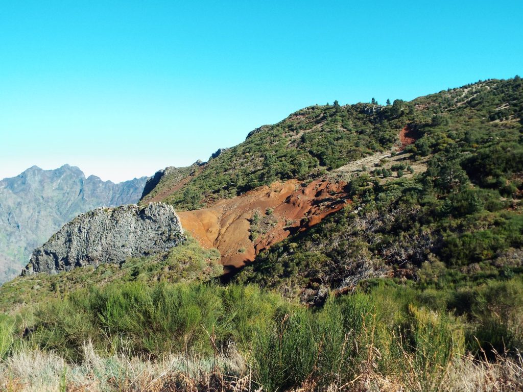
The third viewpoint, Boca dos Namorados (about 1000 m), is on the other side of the valley, above Jardim da Serra. From here you can see the valley, Eira do Serrado and the central mountains, and a path leads down from it to Curral das Freiras.
How to get to Curral das Freiras
By car
From Funchal you drive through Santo António on the ER107 towards Eira do Serrado. At the fork in Vereda you either turn off to the viewpoint or carry on through Estrela and Ribeira da Lapa to the tunnel which, since 2004, has led straight into the village. The whole drive takes about 20 minutes. The old road from Eira do Serrado down to the village, opened in 1959, is now closed to cars. So to get from the viewpoint to the village, you drive back to the fork and on through the tunnel.
The road is winding and steep, and the slopes above it are crumbling. On 2 September 2026 large rocks fell onto the road to Eira do Serrado, and in April 2025 a landslide closed the ER107 between Curral and Colmeal. After heavy rain, check the road notices.
Paredão by car only. Bus 181 will take you to Eira do Serrado and to the village, but it doesn’t go to the viewpoint on the forest road to Pico do Areeiro.
Links marked are affiliate links: if you book something through them, I earn a small commission · why?
Enjoying this guide? I’m really glad. It’s possible because some of the links are affiliate links – I mark them with an arrow. It doesn’t cost you anything extra. How this guide makes money
By bus 181
Curral das Freiras is served by Horários do Funchal route 181 (numbered 81 until March 2026). It leaves from the stop by the lower station of the Monte cable car (Teleférico, Rua José da Silva “Saca”) and ends at Lombo Chão, deep in the valley. A ticket from the driver costs €2.65, or €1.30 for children aged 6–12. There are 18 buses from Funchal on weekdays, 8 on Saturdays and 7 on Sundays and public holidays (route 181 timetable, PDF).
Only some services go via Eira do Serrado:
| Day | From Funchal | From Lombo Chão to Funchal |
|---|---|---|
| Weekdays | 9:00*, 10:00, 11:00 | 11:15, 13:40, 14:30, 16:15 |
| Saturdays | 8:45, 10:00, 11:30 | 13:15, 14:30 |
| Sundays and public holidays | 9:05, 11:40 | 13:00, 14:30 |
If you’re getting off at Eira do Serrado, tell the driver when you board. The 9:00 service goes that way on request: if you want to board at Eira do Serrado, book it on 291 705 563 by midnight the day before.
On a tour
Organised tours to the Nuns’ Valley usually take half a day. You travel by minibus or open-top jeep via the viewpoints above Funchal to Eira do Serrado, and some tours also drive down into the village. Some combine the valley with Pico do Arieiro or with Cabo Girão.
On foot from Eira do Serrado to the village
Before the road was built in 1959, people walked to Curral, and the main way in led from Eira do Serrado down the steep Passo da Chave descent. Today the path is 2.7 km long, takes about 2 hours and runs from 1095 to 654 m, almost all of it on cobbles. It’s best walked downhill, from the viewpoint to the historic centre. The path isn’t a PR trail, so it isn’t on the IFCN list. The fire of August 2024 spared it.
A plan without a car: bus 181 at 10:00 (on weekdays) to Eira do Serrado, the walk down to the village, lunch and the bus back from the centre. The timetable shows departure times from the Lombo Chão terminus. The stops in the centre (Igreja, Bica) come later on the route to Funchal.
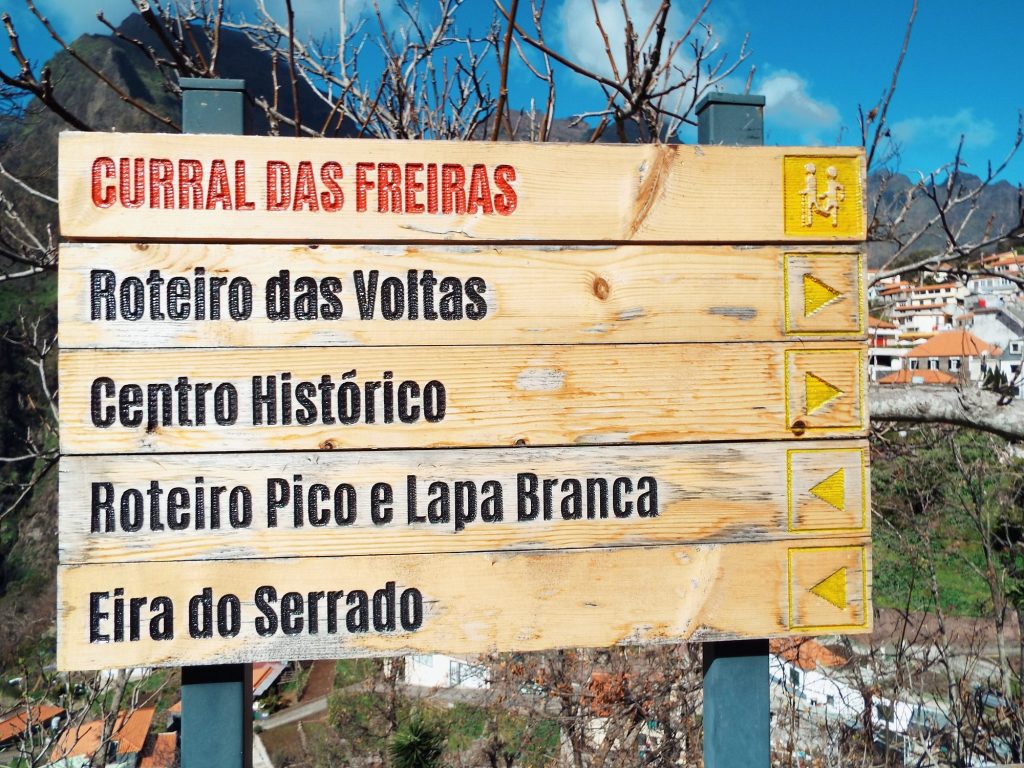
PR2 Vereda do Urzal and the way to Pico Ruivo
From the valley up into the mountains runs the PR2 Vereda do Urzal trail: 10.3 km from Fajã dos Cardos in Curral das Freiras to Boaventura in the north, about 4.5 hours, moderate. First it climbs for a long time to the Boca das Torrinhas pass, then descends through the laurel forest. According to IFCN (as of 2 October 2026), the trail is open. The trail ticket costs €4.50 and must be paid in advance in the SIMplifica system (how to buy a trail ticket).
Since 18 June 2026 you can once again walk from Boca das Torrinhas along the PR1.3 section to Pico Ruivo. The section further on to Encumeada is still closed. For the current situation, see the Madeira trail status page.
After the 2024 fire
In August 2024 a fire swept through the middle of the island. It started on 14 August in Serra de Água, and on 20–21 August it reached Pico Grande and Curral das Freiras. About 200 residents were asked to leave their homes, crops burned in several parts of the parish, and the junta (parish council) closed almost all the mountain paths. In total, about 5100 ha burned.
The village: church, chestnuts and ginja
In the centre of the village stands the church of Nossa Senhora do Livramento, from the early 19th century. The high altar and side altars were made in 1916–1918: carved by Manuel Inocêncio de Sousa and painted by José Zeferino. The vault above the altar is painted too. The parish feast falls on the last Sunday of August. It was once one of the most important pilgrimages on Madeira, and pilgrims came here on foot.
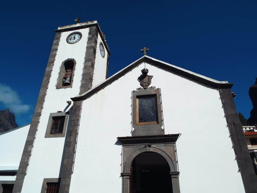
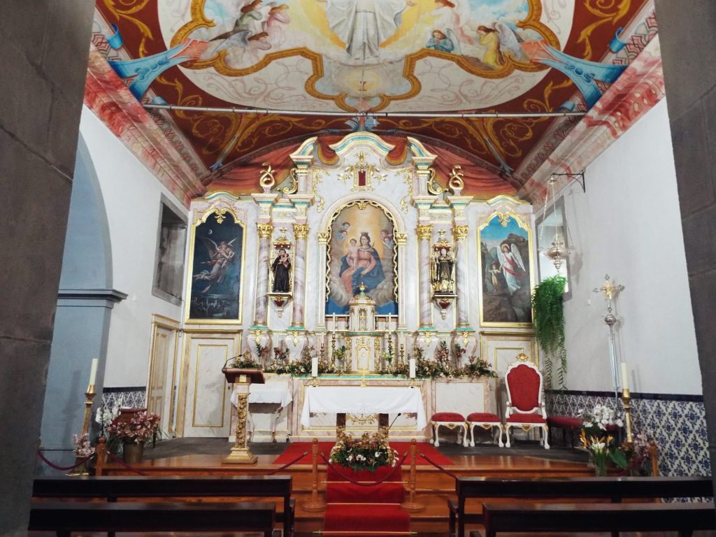
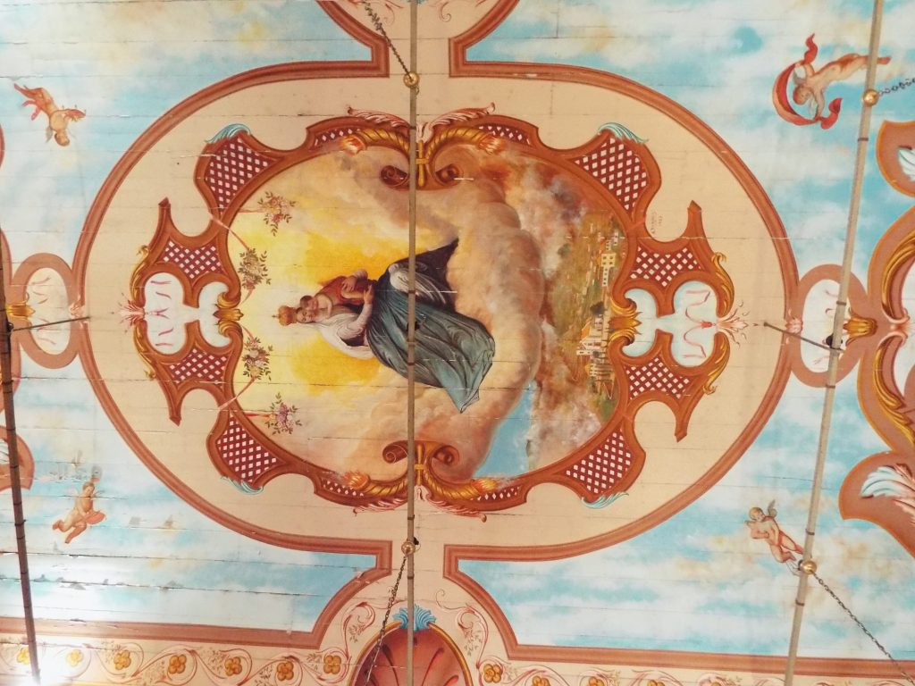
1: The church in Curral das Freiras, 2: The altar of the church in Curral das Freiras, 3: The painted ceiling of the church in Curral das Freiras. Photos: Anita Podrez and Andrzej Podrez
Curral is famous for its chestnuts. In the restaurants you can have chestnut soup (sopa de castanha), chestnut cakes and biscuits, and wash them down with chestnut liqueur (licor de castanha) or ginja, a cherry liqueur. My parents came here on an organised tour and, of course, tried the chestnuts. They love them and say they taste a bit like sweet potatoes. The junta also recommends dishes made with brigalhó, a tuber similar to taro. Round the corner from the Sabores do Curral restaurant is the small Museu da Castanha (chestnut museum), with the history of chestnut growing and old tools (in 2025 entry cost €1, cash only).
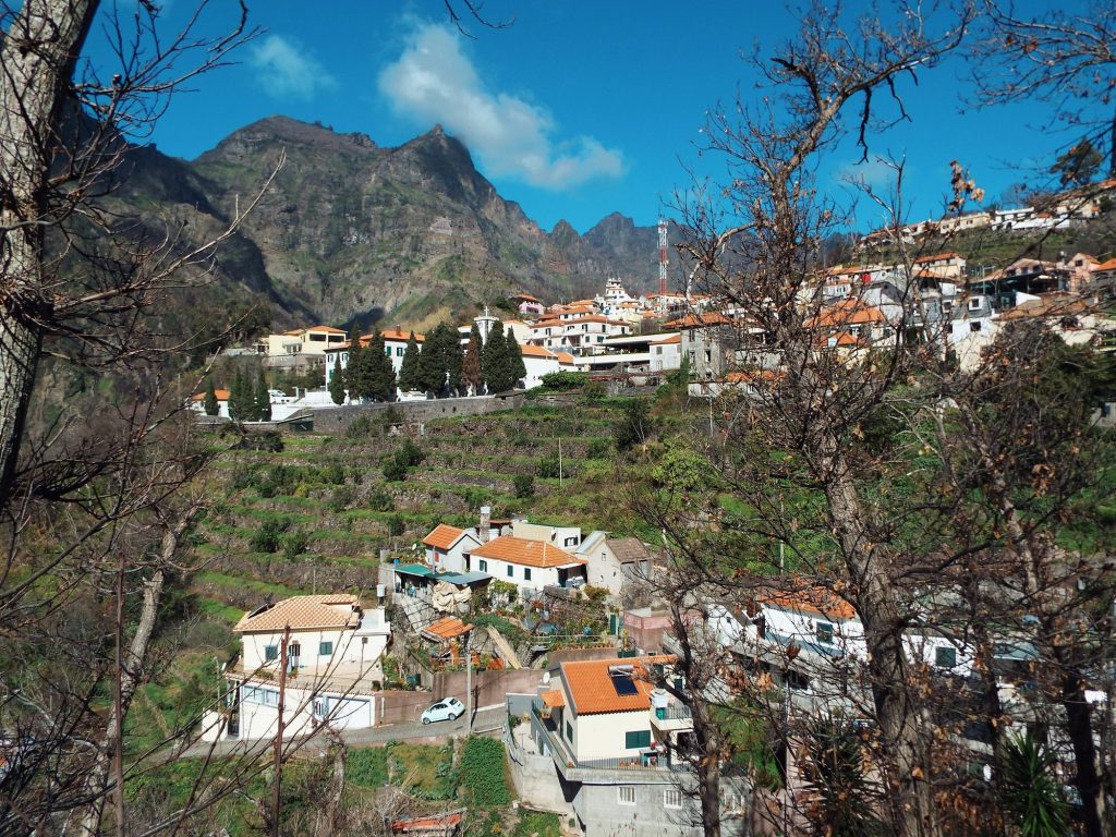
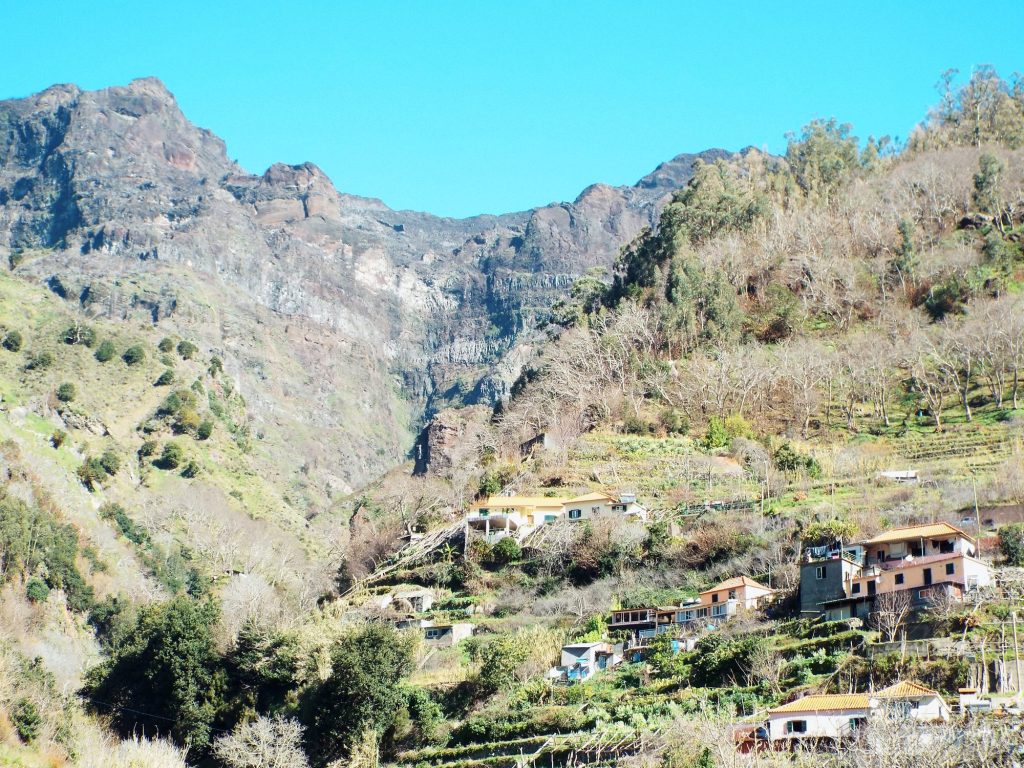
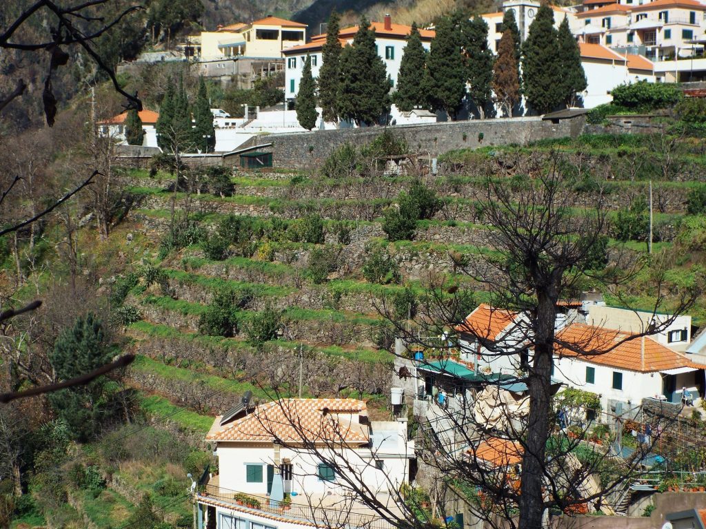
1: The houses of Curral das Freiras below the mountains, 2: Houses on terraces below the rock walls, 3: Terraces and cypresses in Curral das Freiras. Photos: Anita Podrez and Andrzej Podrez
Festa da Castanha 2026
The village’s biggest celebration is the Festa da Castanha (chestnut festival), held on 1 November since 1983. In 2026 it falls on a Sunday. The highlight is a parade with more than 350 costumes and floats, surrounded by dozens of stalls selling chestnuts, walnuts, liqueurs and cakes. Horários do Funchal adds extra route 181 services that day, and the last bus back to Funchal is at 20:35. To find out what else is happening on the island at this time of year, read Madeira in November.
Is Curral das Freiras a volcanic crater?
From above, the valley looks like a crater, and for years that’s how it was described. Geologists say otherwise: it’s an erosion valley. The upper course of the Ribeira dos Socorridos, the most important river in the south of the island, carved it out of older, more weathered rock. That’s why the basin is round while its outlet is narrow and V-shaped. The village itself stands on a huge landslide of about 100 million m³.
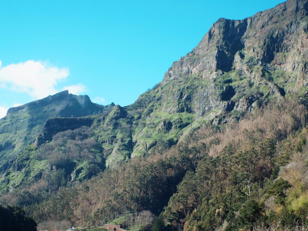
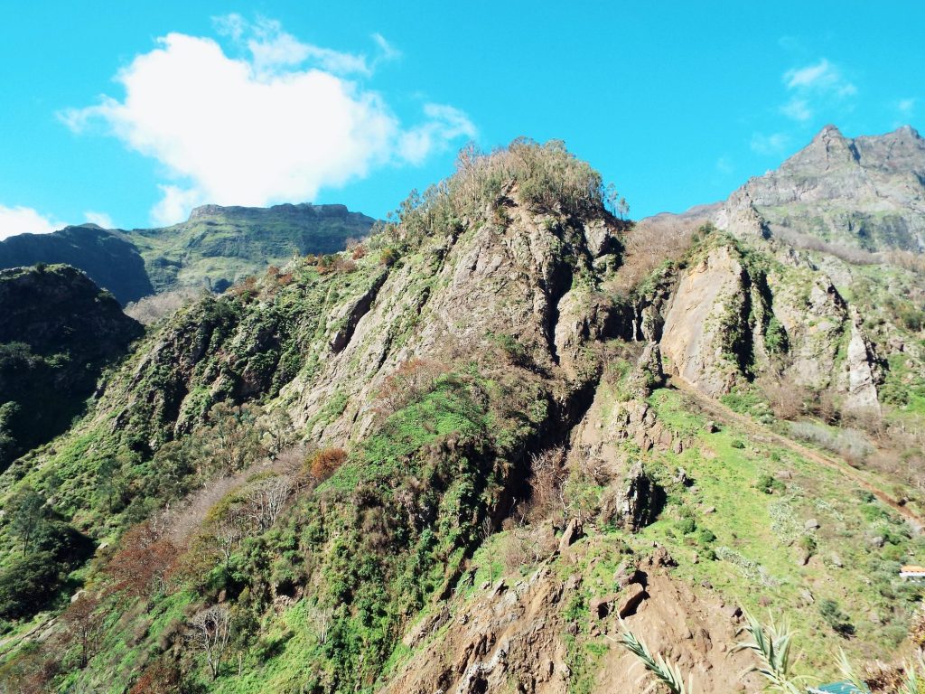
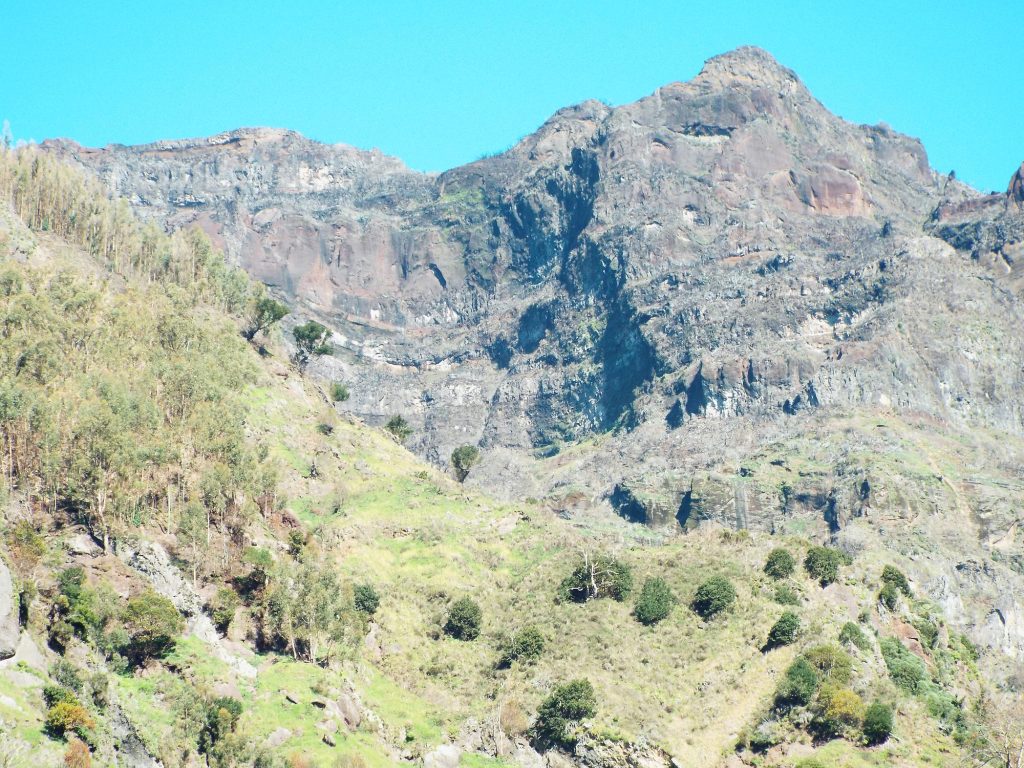
1: The peaks above the village, 2: A green ridge above Curral das Freiras, 3: A rock wall above the valley. Photos: Anita Podrez and Andrzej Podrez
A half-day plan
- In the morning, by car or bus 181 to Eira do Serrado, then 300 m up the steps to the viewing terrace.
- The walk down the old path to the village: 2.7 km, about 2 hours.
- The church of Nossa Senhora do Livramento and the Museu da Castanha.
- Lunch: chestnut soup, then chestnut cake and a glass of ginja for dessert.
- Back to Funchal on bus 181 from the centre. With a car, add Paredão or sunrise at Pico do Arieiro.
For more ideas on exploring the island, see Things to do in Madeira: 20 attractions and a 7-day plan.
Curral das Freiras: frequently asked questions
Where is the Nuns’ Valley in Madeira?
In the central part of the island, about 16 km from Funchal, in the municipality of Câmara de Lobos. The village of Curral das Freiras lies at the bottom of the valley, about 650 m above sea level, and the Eira do Serrado viewpoint at 1095 m.
How do I get to Curral das Freiras by bus?
On Horários do Funchal route 181 from the stop by the lower station of the Monte cable car. A ticket from the driver costs €2.65. Only some services go via Eira do Serrado, e.g. at 10:00 and 11:00 on weekdays.
How long is the walk from Eira do Serrado to the village?
The old cobbled path is 2.7 km long with about 440 m of height difference. Horários do Funchal gives about 2 hours. It’s best walked downhill, from the viewpoint to the village.
Why is it called the Nuns’ Valley?
From 1480 the land belonged to the Santa Clara convent in Funchal. In 1566 the nuns took refuge here from French corsairs, who plundered Funchal for 16 days.
When is the Festa da Castanha in Curral das Freiras?
Every year on 1 November; in 2026 it falls on a Sunday. The highlights are the parade and the stalls with chestnuts, liqueurs and cakes. Route 181 runs more often that day, and the last bus back to Funchal is at 20:35.
Can I walk from Curral das Freiras to Pico Ruivo?
Yes. The PR2 trail takes you to the Boca das Torrinhas pass, and from there the PR1.3 section, reopened on 18 June 2026, leads to Pico Ruivo. The PR2 trail ticket costs €4.50 and must be paid in advance in SIMplifica.
Want to see my guides more often on Google?
Add madeira-planner.com as a preferred source on GoogleData checked 25 October 2026.
Sources I used (35)
- Junta de Freguesia do Curral das Freiras (parish council): history of the parish; getting there; heritage; food; traditions; founding of the parish
- Statistics and geology: DREM – population in the censuses 1864–2021; Eira do Serrado geosite sheet; IPMA – report on the August 2024 fire
- Visit Madeira: Curral das Freiras; Eira do Serrado; Miradouro do Paredão; Boca dos Namorados; church of Nossa Senhora do Livramento; PR2 Vereda do Urzal; Hannah & Nick blog (2025) – Museu da Castanha
- Transport and trails: Horários do Funchal – route 181 timetable; HF – Festa da Castanha 2026 services; HF – Eira do Serrado – Curral das Freiras path; HF – Eira do Serrado; SIGA – new route numbering; IFCN – PR trails; IFCN – trail notices
- Elucidário Madeirense: Curral das Freiras; the French raid of 1566; Santa Clara convent
- Media: DNoticias – road and tunnel; DNoticias – the 2024 fire in Curral; DNoticias – paths after the fire; DNoticias – forest road to Areeiro; Lusa – landslide on the ER107 (2025); DNoticias – rocks on the road (2026); DNoticias – PR1.3 reopened (2026); Câmara de Lobos municipality – Festa da Castanha; DNoticias – Festa da Castanha 2025